There is a place on this planet made up of a narrow, jagged strip of land, wedged between the world’s two most populous countries, India and China. These two nations exert permanent pressure on Nepal, most often treated as a poor relative. Yet this small, self-sufficient country is populated by exceptional humans.
To the north, Nepal is separated from Tibet by the Himalayan range, home to the world’s highest peaks, while the Terai lowlands act as the boundary with India, not far from the Ganges River. “Nepal belongs to the Indian cultural sphere,” explains CNRS researcher Blandine Ripert. “Since the 1950 Treaty of Peace and Friendship, the open (and unsecured) border with India has allowed workers to move freely between the two countries, deepening Nepal’s economic dependence on its southern neighbor. India’s cultural and religious influence has deep roots, particularly through Hinduism, which remained the state religion until the monarchy’s abolition in 2008.”
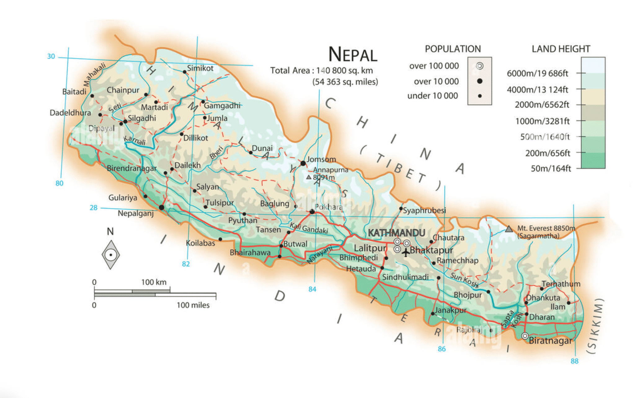
For decades, Nepal has been renowned as a premier destination for mountaineering—of the fourteen Himalayan peaks towering over 8,000 meters, eight are in Nepal—and for long-distance trekking. Among the most popular routes are the Annapurna Circuit, the Everest Valley, and Manaslu. People from all over the world come to experience this natural treasure.
In this culturally diverse country—home to 122 languages, sixty castes, and seventy districts—there are still regions entirely untouched by human development, where the Anthropocene has yet to leave its negative mark on the flora and fauna.
Most of what could be called Nepal’s Far West is several days’ walk from the nearest town. In this remote and challenging terrain, with its numerous high-altitude passes (over 5,000 meters), time seems to be literally standing still. The majestic landscapes and rich cultural heritage make it a unique destination, but its geographic isolation limits access and helps preserve its ancestral traditions.
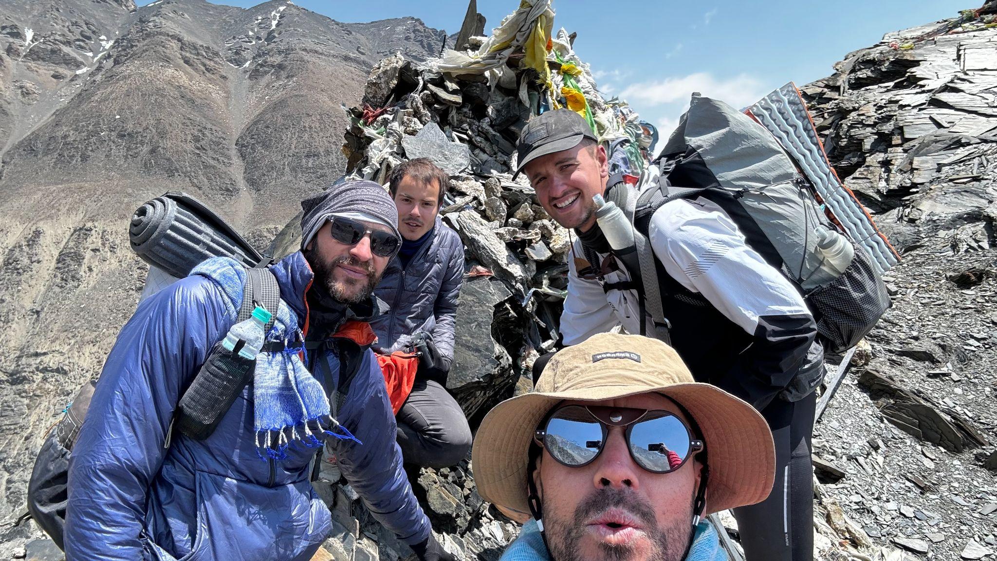
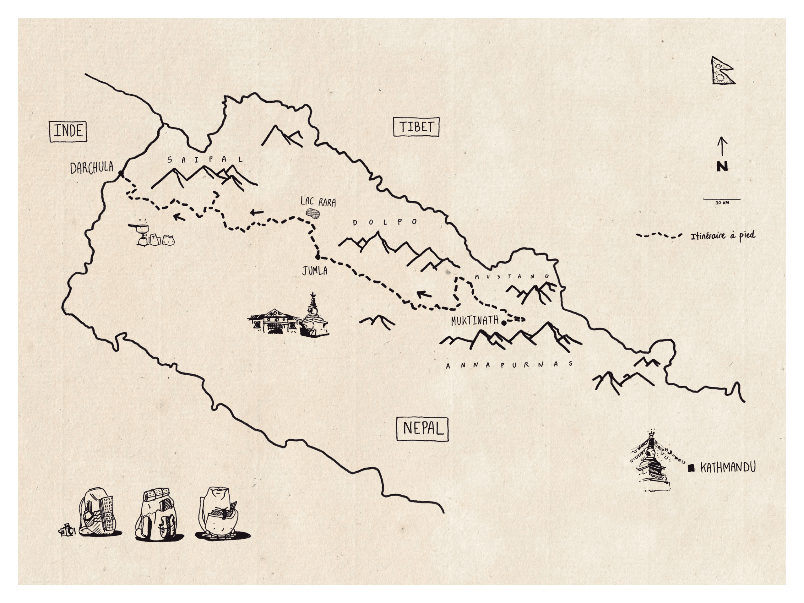
This adventure is the story of three friends who are developing a multi-stage project called #ultracitadins (see the end of the article). They have traveled a section of the Transhimalayan route in a minimalist style known as fast hiking, without a tent, in search of a path that crosses western Nepal—from the foothills of Annapurna to the Indian border—staying as close as possible to the high Himalayan mountains that lead to Tibet. They had five weeks to accomplish this feat.
“Certain individuals hoped to enter into History. We were the ones who simply wanted to disappear into the geography of the landscape.” – Sylvain Tesson
An inhospitable geography
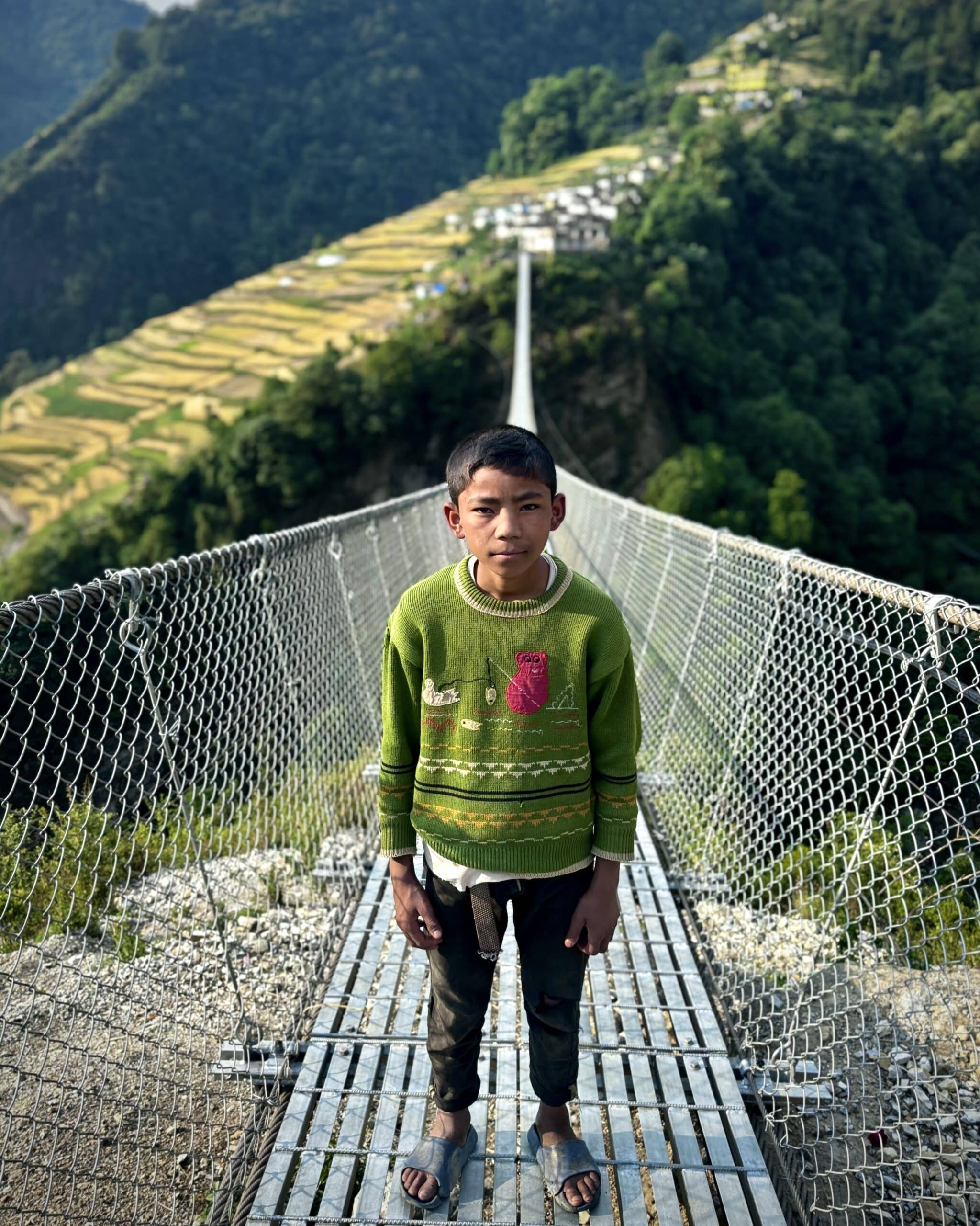
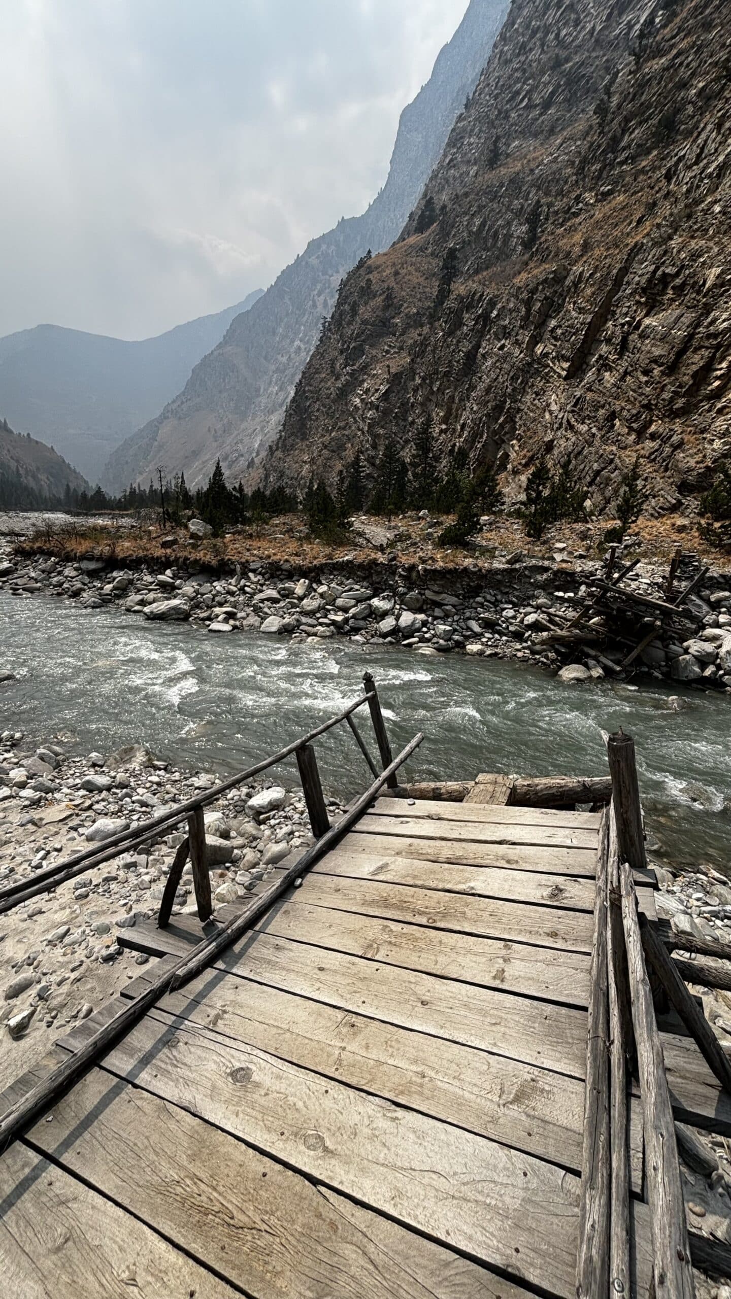
Accessing western Nepal is a formidable challenge, and this was the first we encountered. The limited infrastructure made travel arduous: roads are often impassable during the monsoon season, and the few scattered villages are connected only by precarious suspension bridges. Most people travel on foot or by pack mule. This isolation directly impacts their daily life, making basic services like education and healthcare difficult to access.
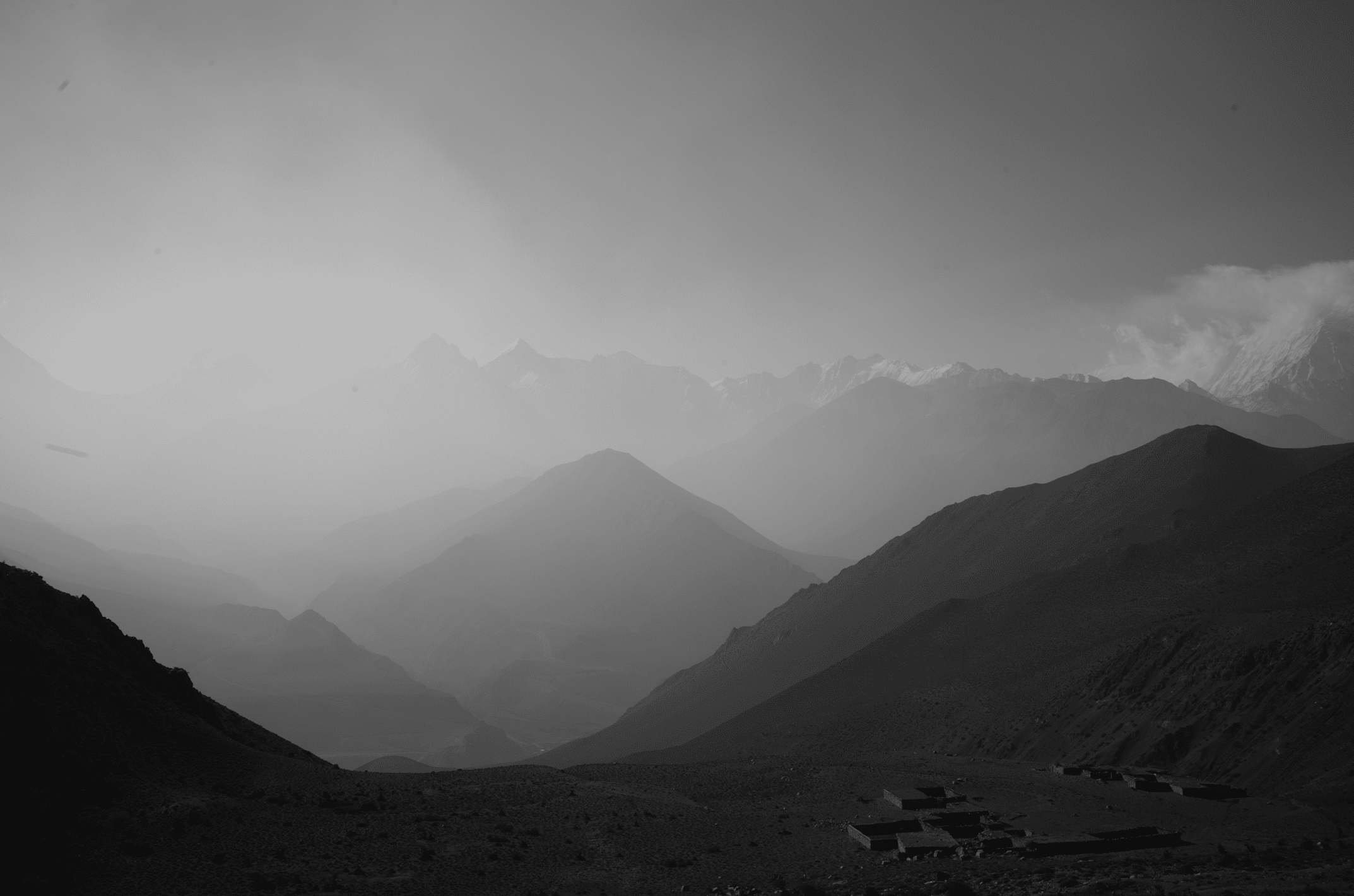
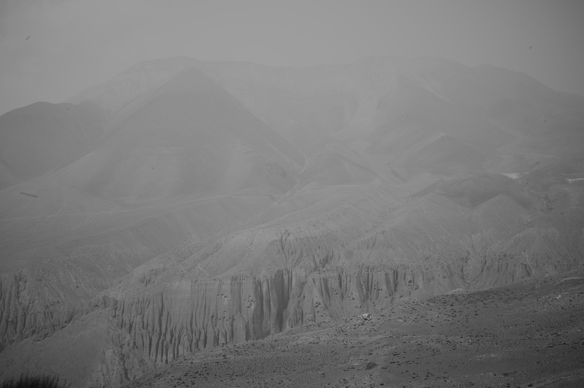
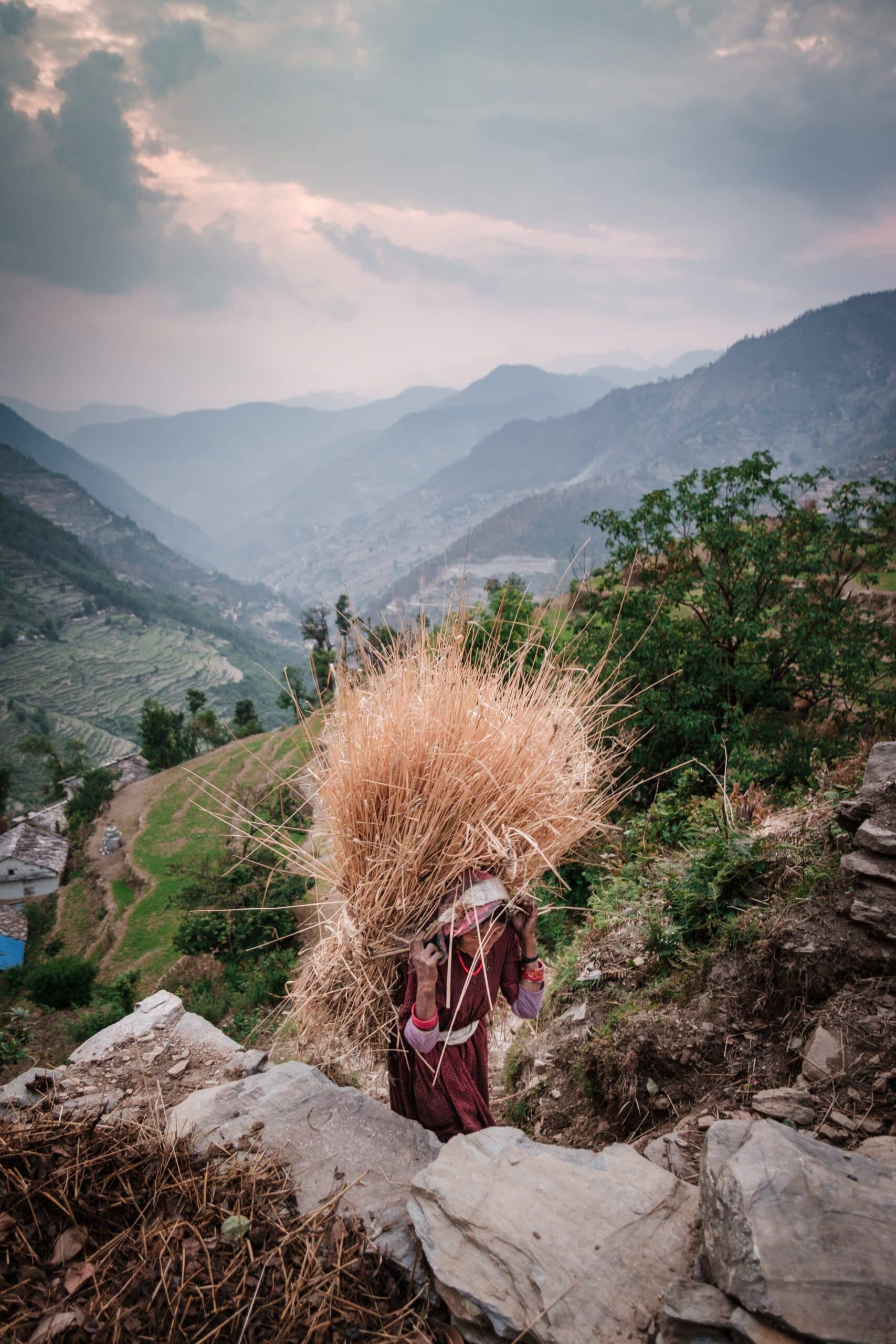
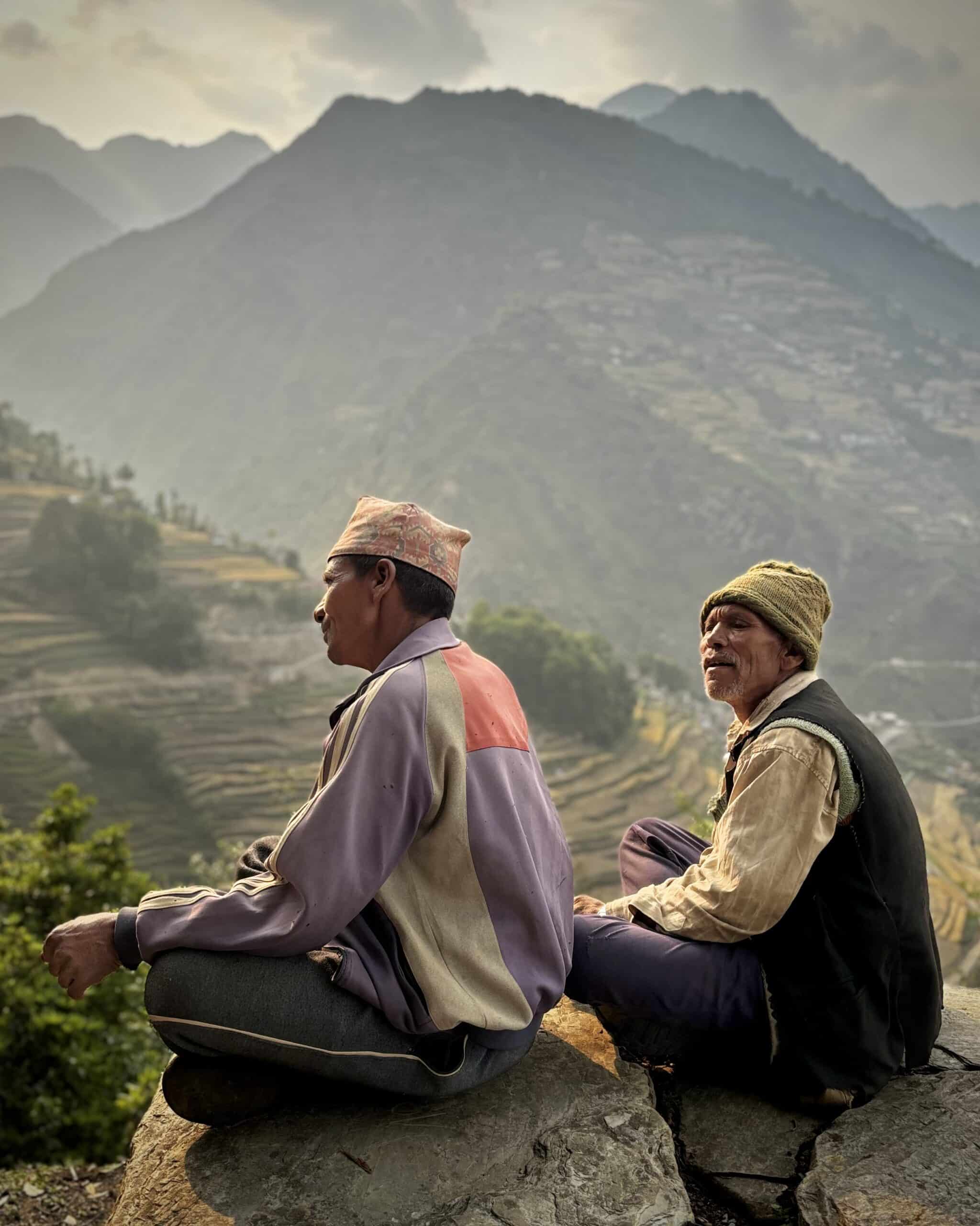
The Nepalese Far West is synonymous with spectacular yet often inhospitable geography. The region is dominated by towering Himalayan peaks, deep valleys, and surging rivers. The mountain districts we traverse—Humla, Jumla, Dolpa, and Mugu—are among the most remote in the country. The rugged terrain, coupled with unpredictable weather, adds an extra layer of complexity to every journey. On any given day, we would experience all four seasons.

Unspoiled cultural heritage
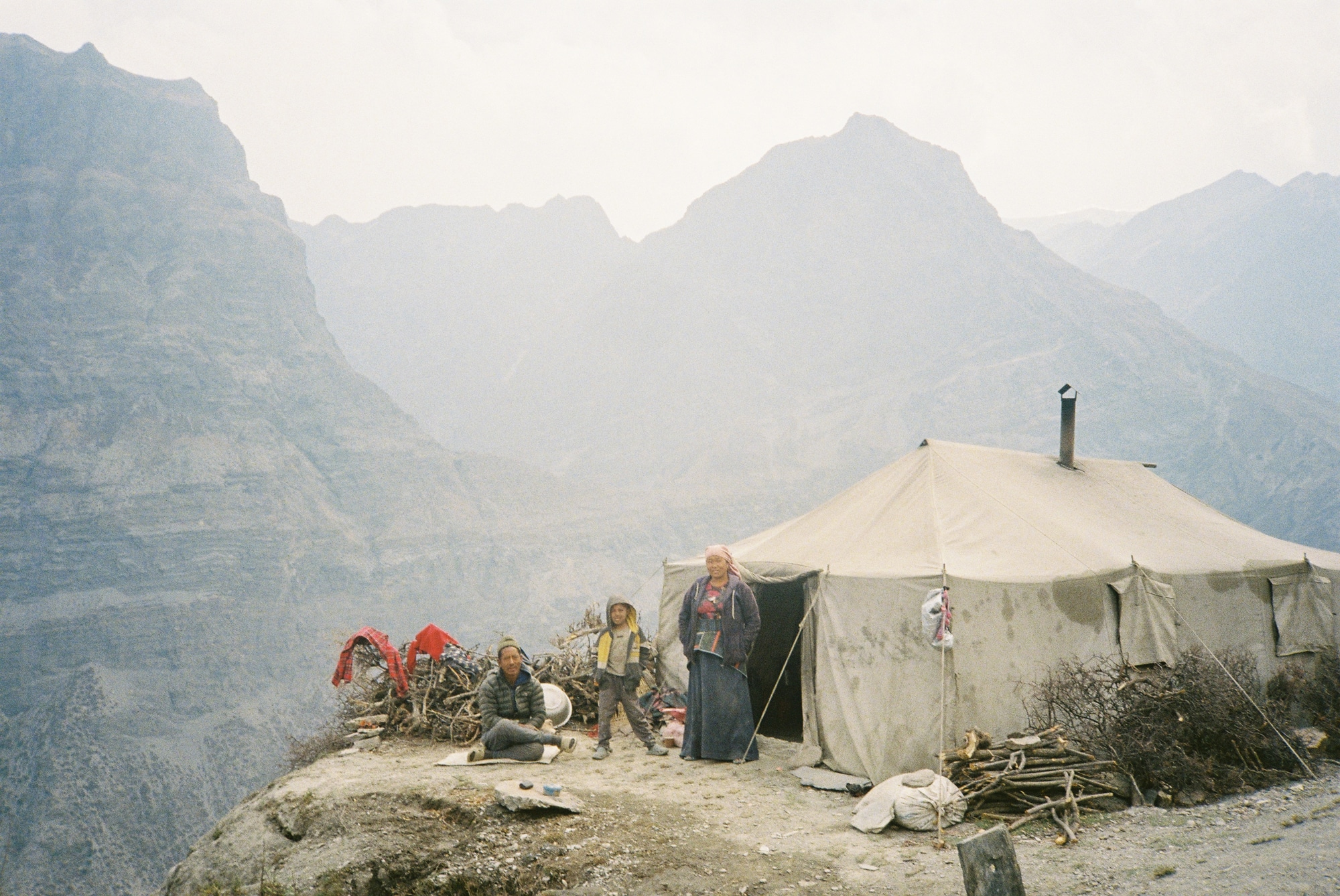
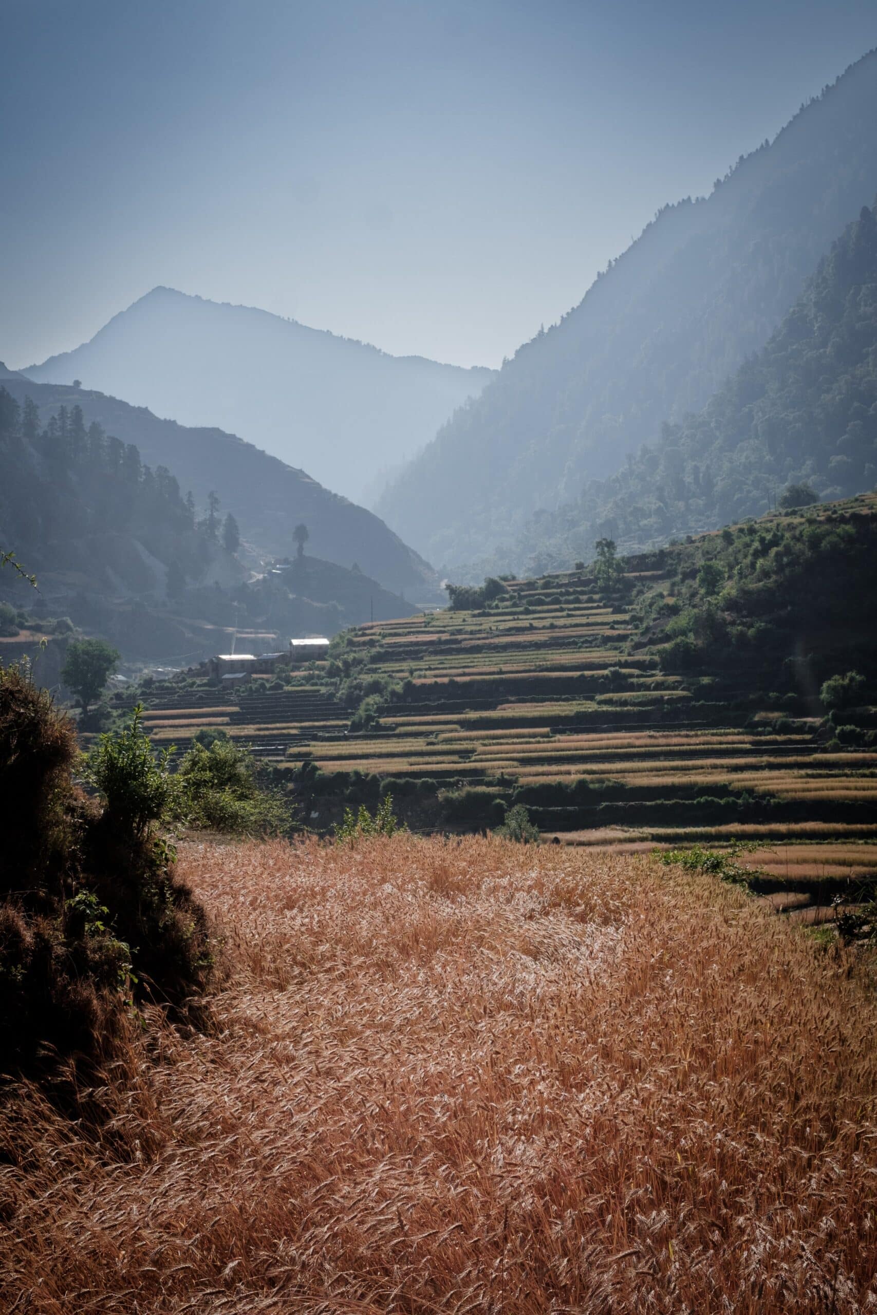
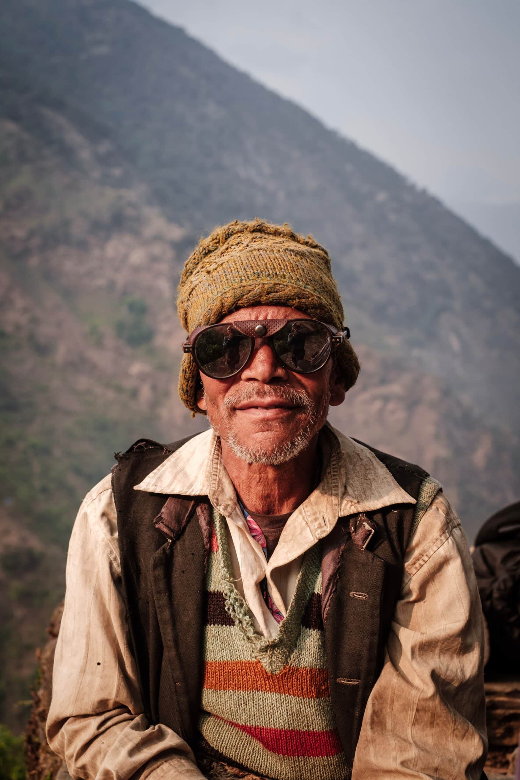
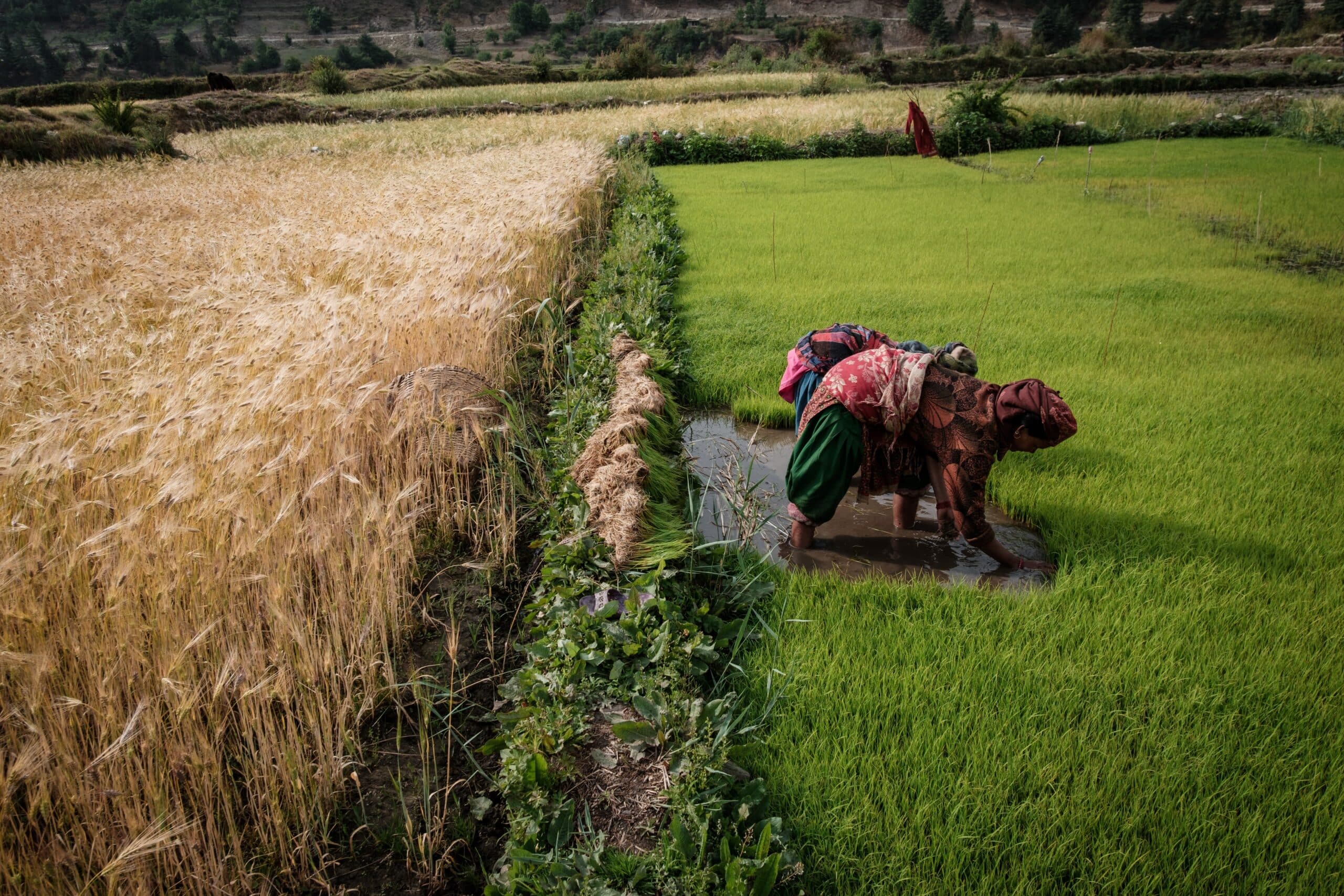
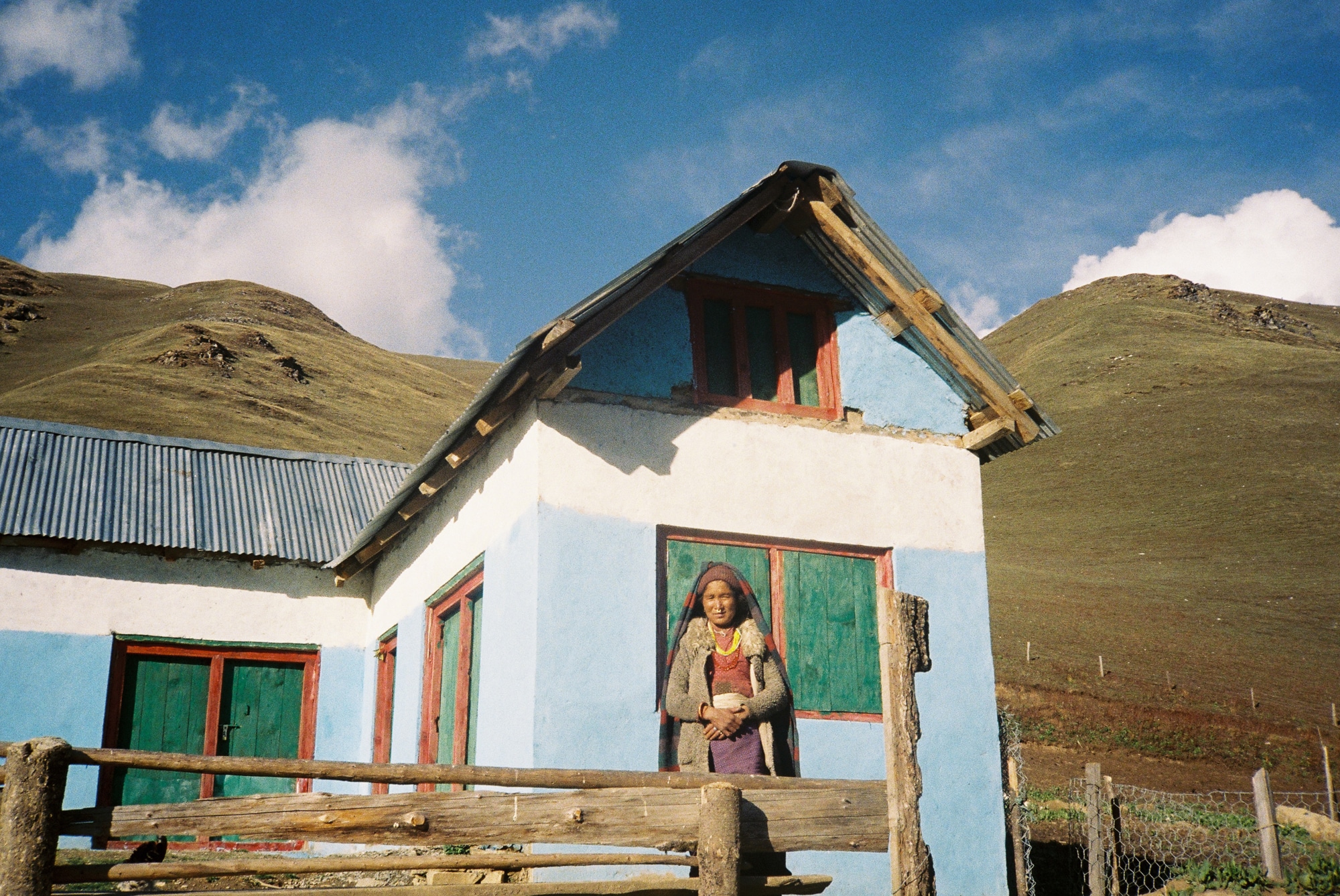
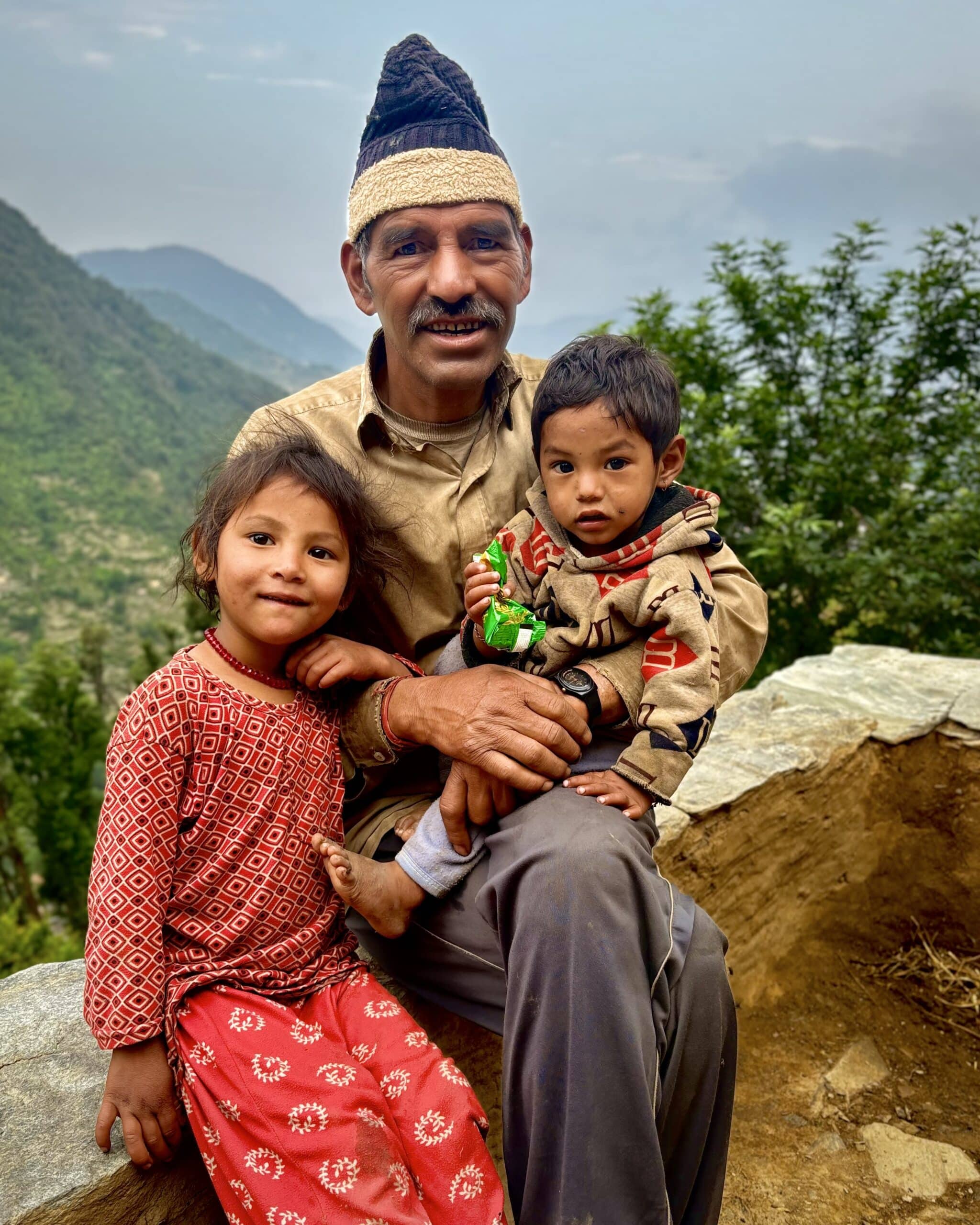
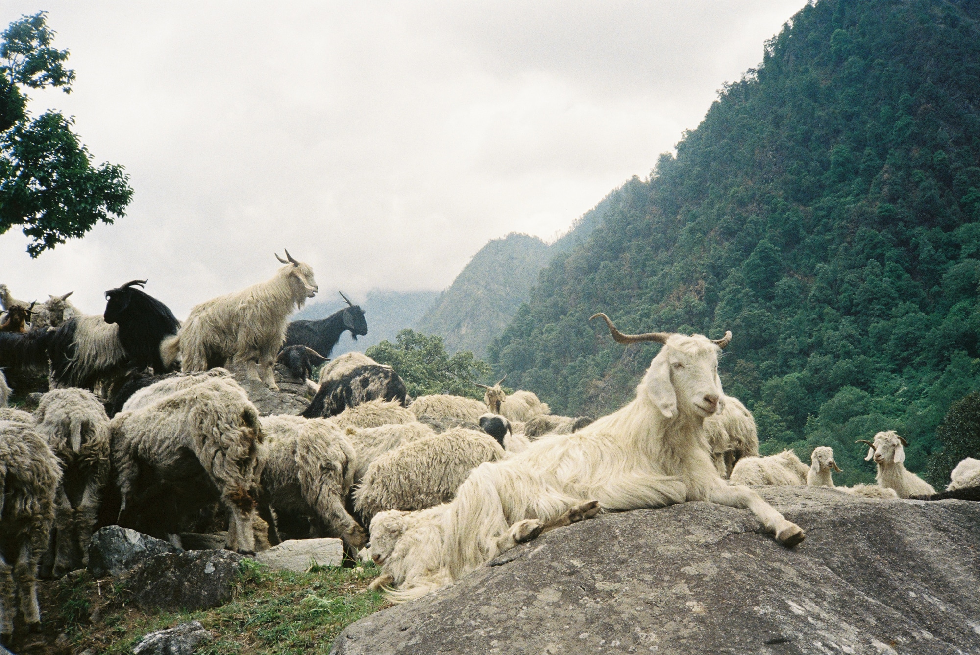
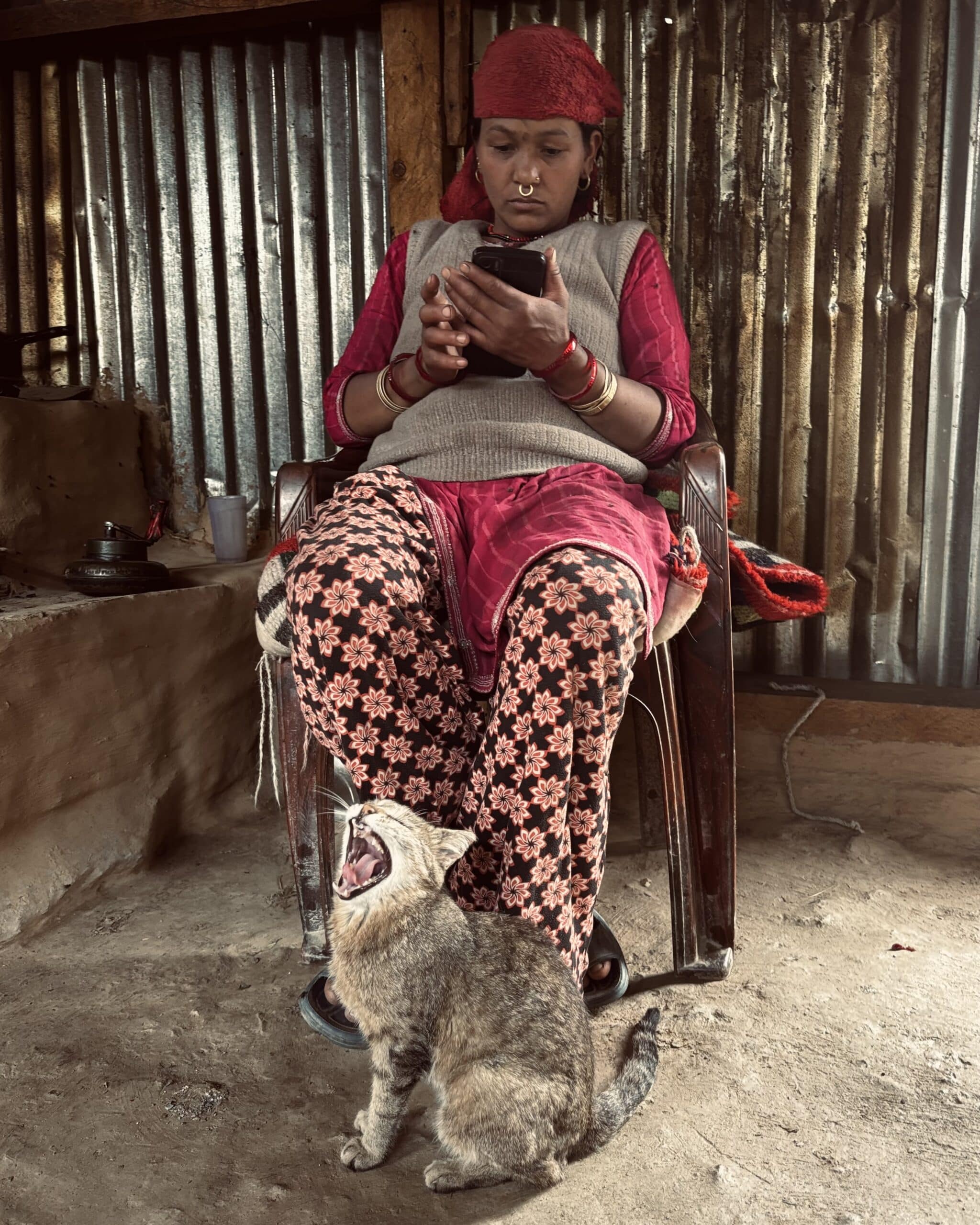
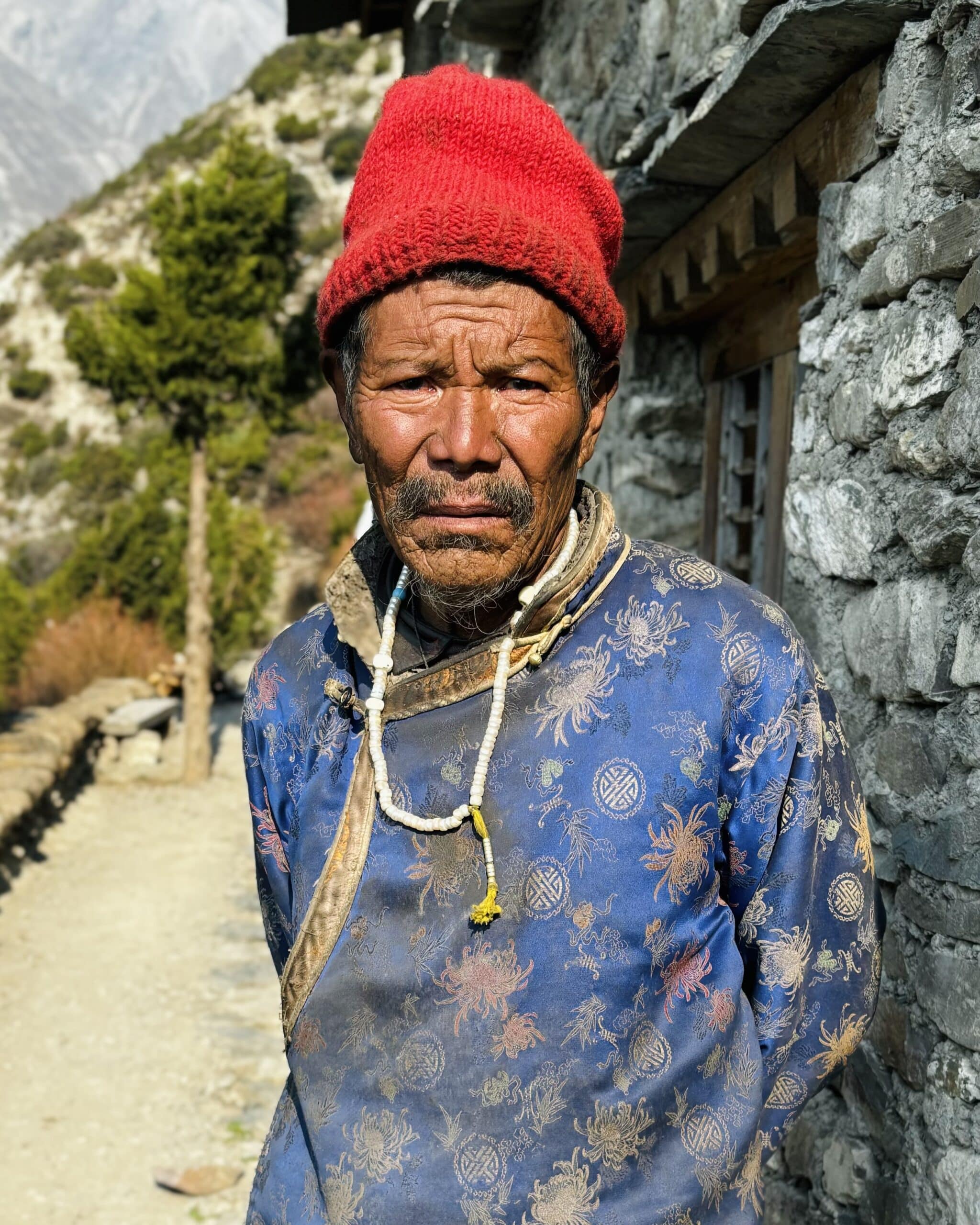
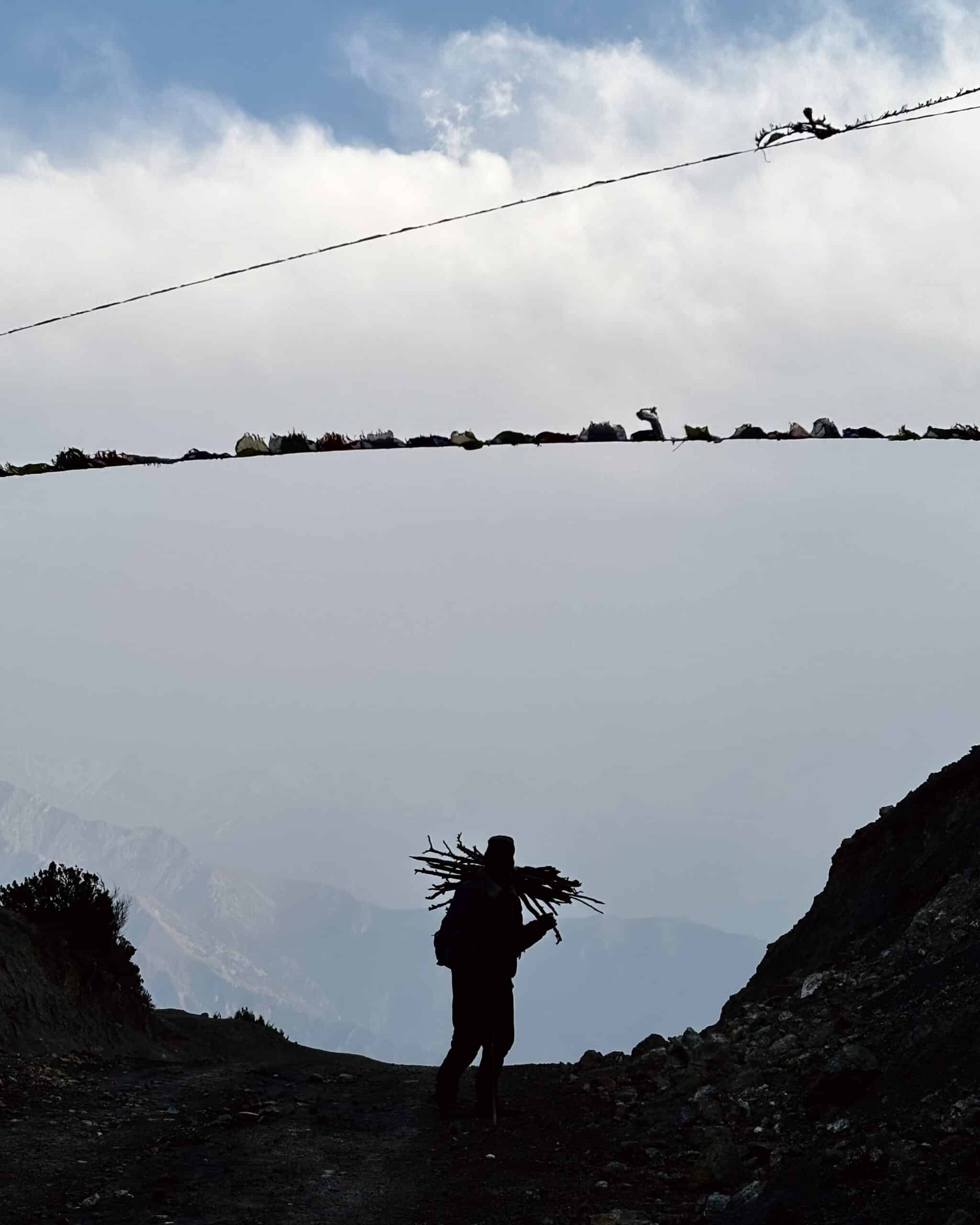
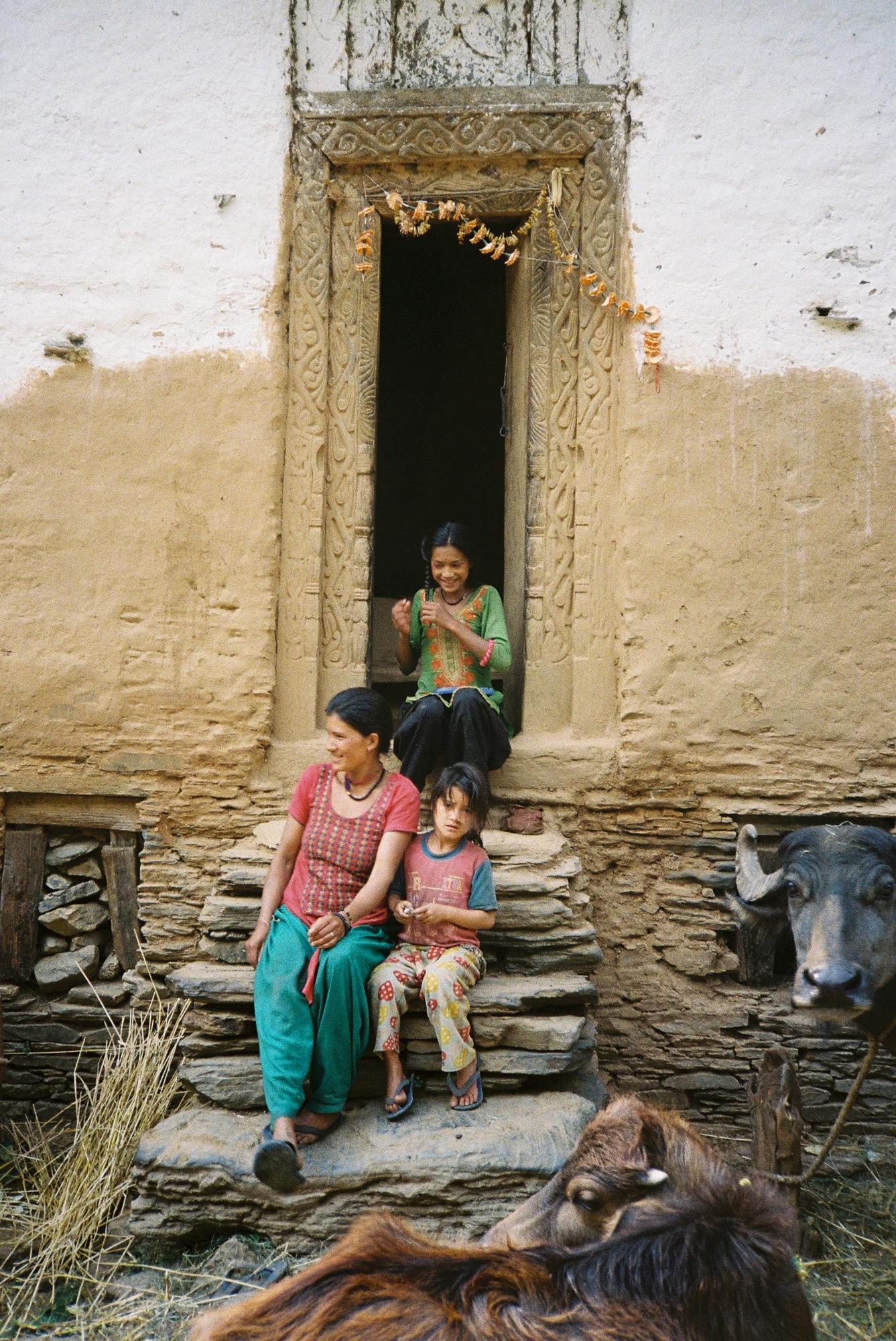
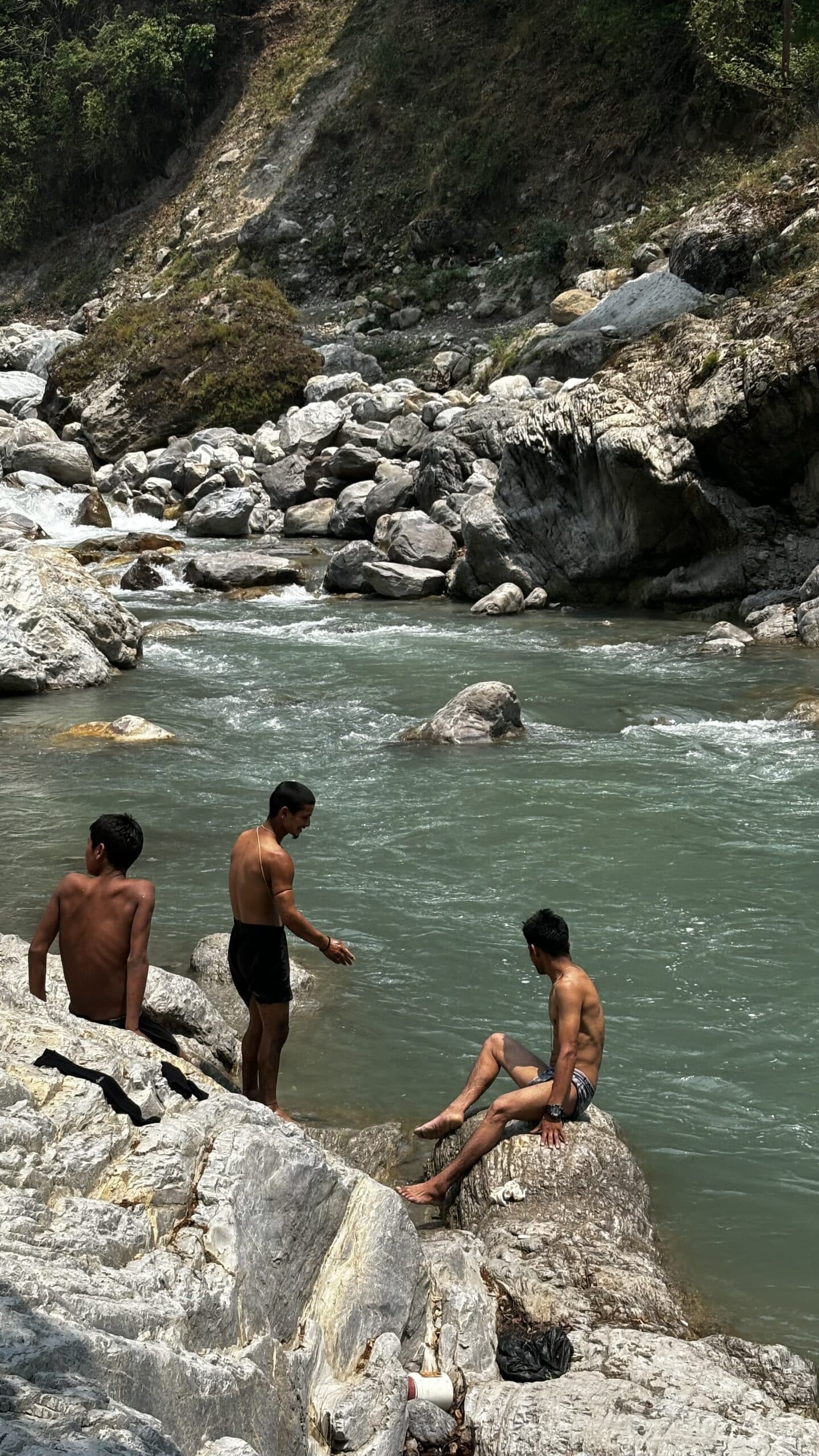
The isolation of western Nepal has helped to preserve its unique cultural traditions. The inhabitants, primarily from ethnic groups like the Thakuri, Magar, Sherpa, and Tamang, maintain a traditional way of life. Agriculture and animal husbandry, using ancestral methods passed down through generations, remain the main economic activities. We encountered no machinery—everything is done manually, relying on the physical strength of both people and animals.
The terraced fields carved into the mountains are a testament to this ancient knowledge. Villagers rely primarily on subsistence farming, growing millet, wheat, and corn, and raising livestock. Local artisans, such as weavers and blacksmiths, also continue to practice traditional crafts. “In every valley and on every hill, Nepal bears the marks of our ancient heritage,” says Kumar, a Nepalese farmer from the Dolpo region. “Our songs, dances, and customs are like the rivers flowing from our mountains: they nourish our soul and keep our history alive.”
Despite the geographical challenges, the people are proud of their cultural and spiritual traditions. The diverse ethnic communities in the region each have their own customs, languages, and beliefs. Local festivals, traditional dances, and religious rituals shape village life, weaving a social fabric deeply connected to ancestral history and beliefs.
The challenges of modernity
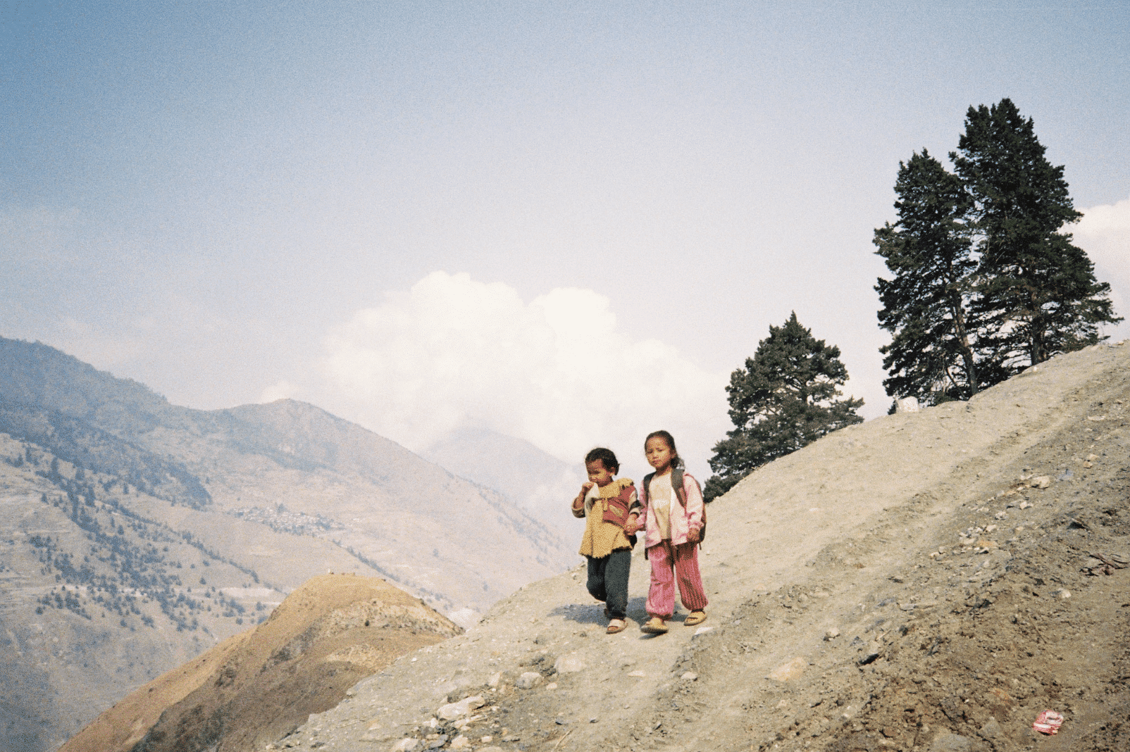
The region’s enchanting authenticity comes at a cost: limited access to health services and education is a significant challenge. Medical facilities are scarce and often poorly equipped, forcing residents to travel great distances for basic care.
We encountered a resident from Mugu who had his leg crushed by a tree last year. It took him three days on a mule, followed by a jeep and then a bus, to reach a hospital capable of treating him. “Getting to the hospital is like an endless uphill climb,” explains Birman, a resident of Nepal’s Far West. “You must walk for hours, often along steep paths and across raging rivers. Every step is a struggle, but when life is on the line, you find the strength to keep going, even if the hospital feels impossibly far away.”
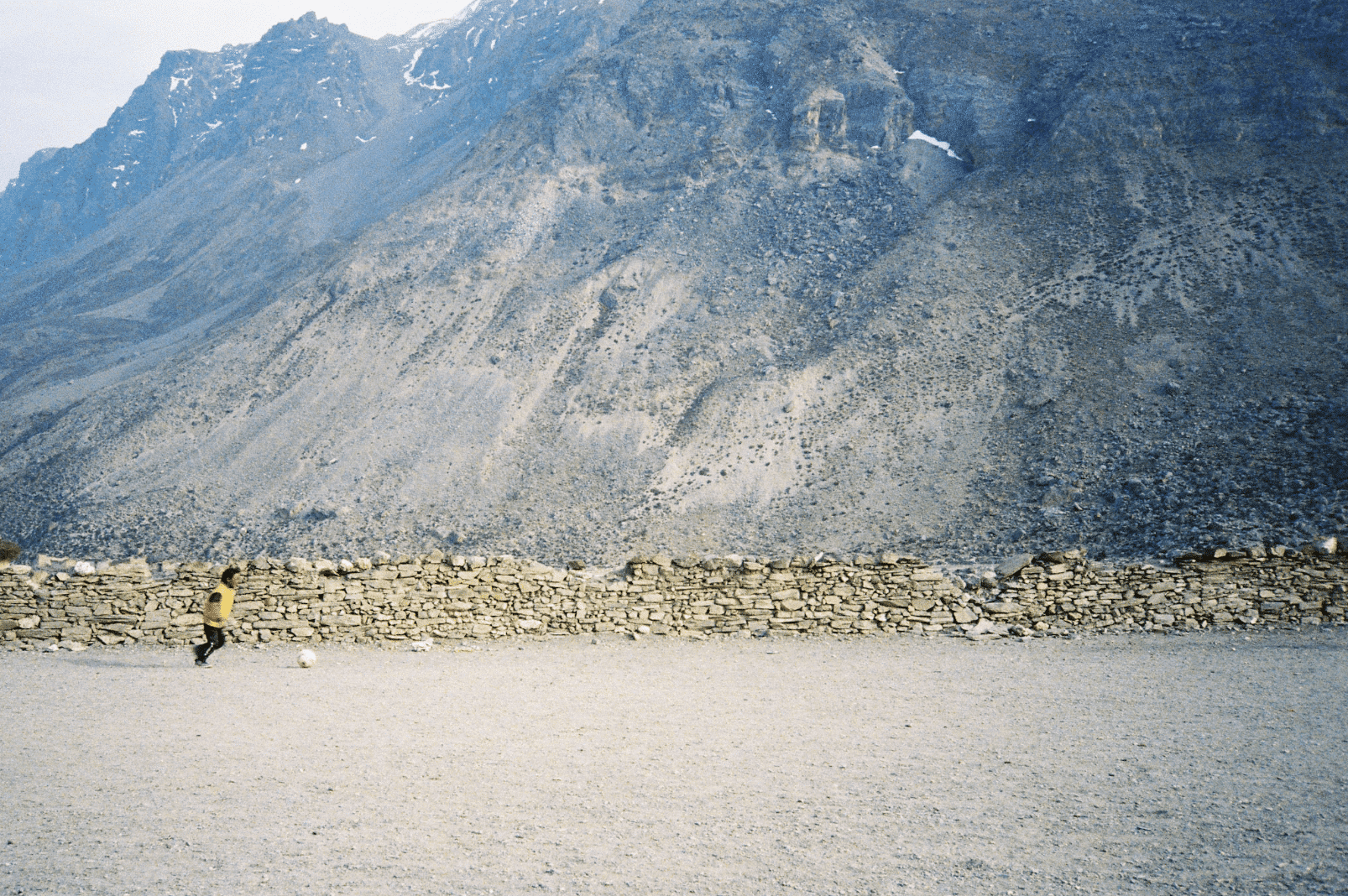
Similarly, there are few schools compared to the number of children, forcing them to walk miles each morning and evening across rugged terrain to reach their classrooms. Arjun, the lama of Chakra Bott, the highest village in the world at 4,300 meters, notes: “In Nepal, schools are like stars in the sky—few and far between. Our children must walk for hours every day, crossing vast landscapes, to reach these places of learning. But that’s the price we pay for a better future.”
Local markets, by necessity, are far less abundant than those back home. For a month, our diet consisted largely of rice, lentils, instant noodles, and crackers. The lack of roads hampers the transportation of agricultural produce to urban centers. This same inaccessibility also hinders the development of tourism, which, despite its enormous potential, remains underexploited. For us, though, this was a blessing in disguise.
The isolation of western Nepal also impacts its demographics: inadequate healthcare, limited educational opportunities, and a lack of economic prospects drive many young people to migrate to the cities or seek work abroad. This migration weakens traditional social structures and leads to the gradual abandonment of ancestral cultural practices. As researcher Blandine Ripert explains: “The process of globalization among the Nepalese is reflected in the introduction of ideas and products from the rest of the world, spread by the increasingly mobile villagers themselves, who are seeking solutions to the difficulties they face at home.”
Wild Wild West
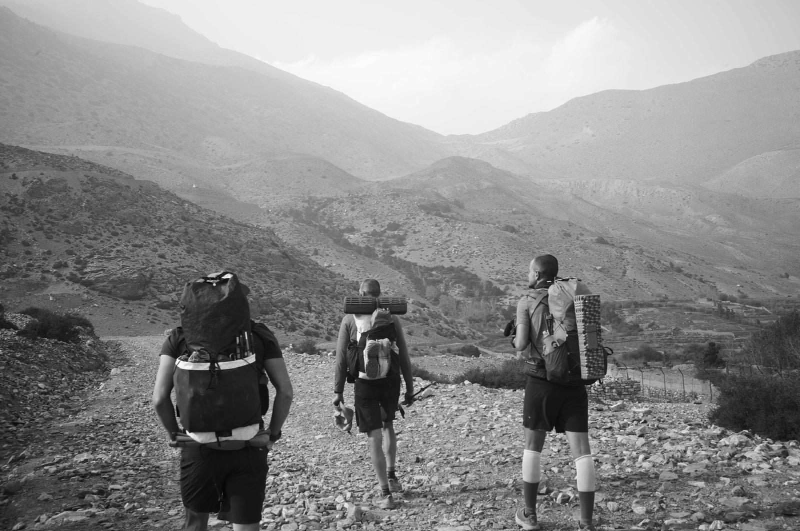
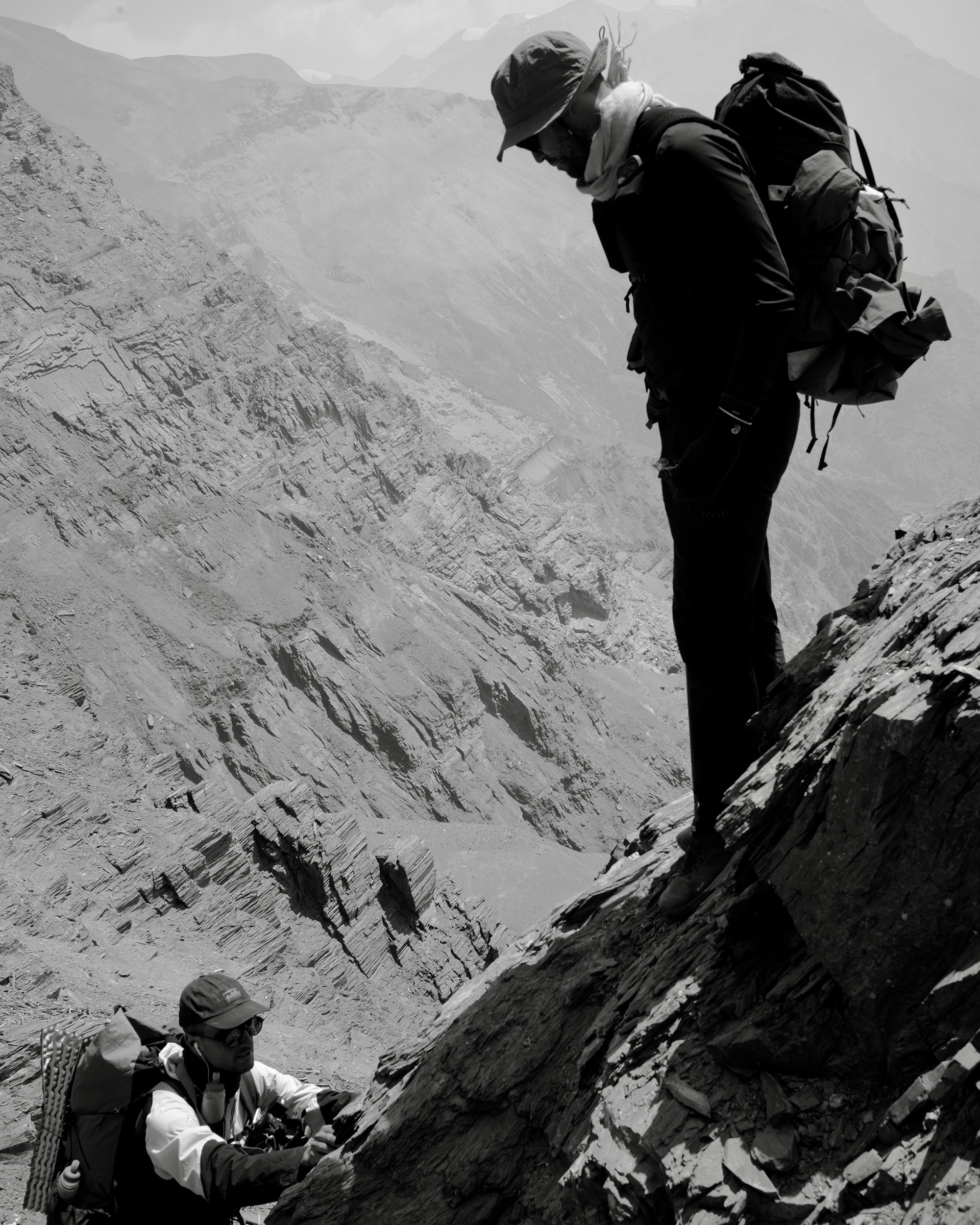
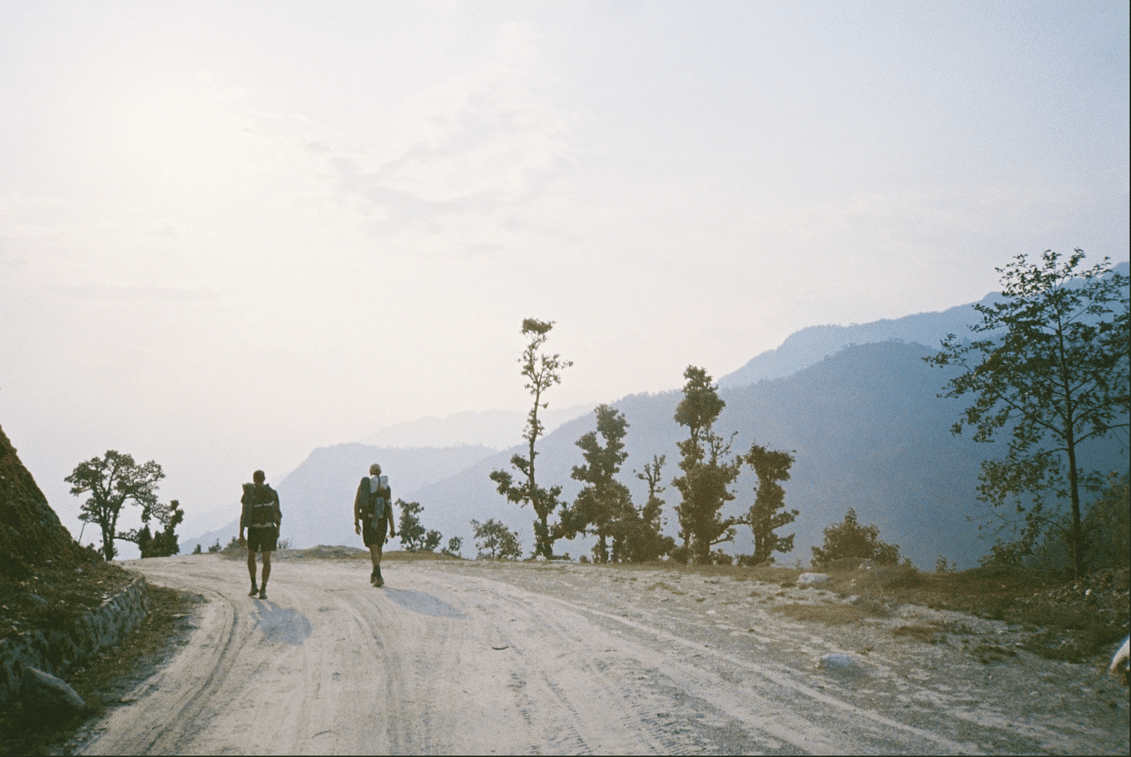
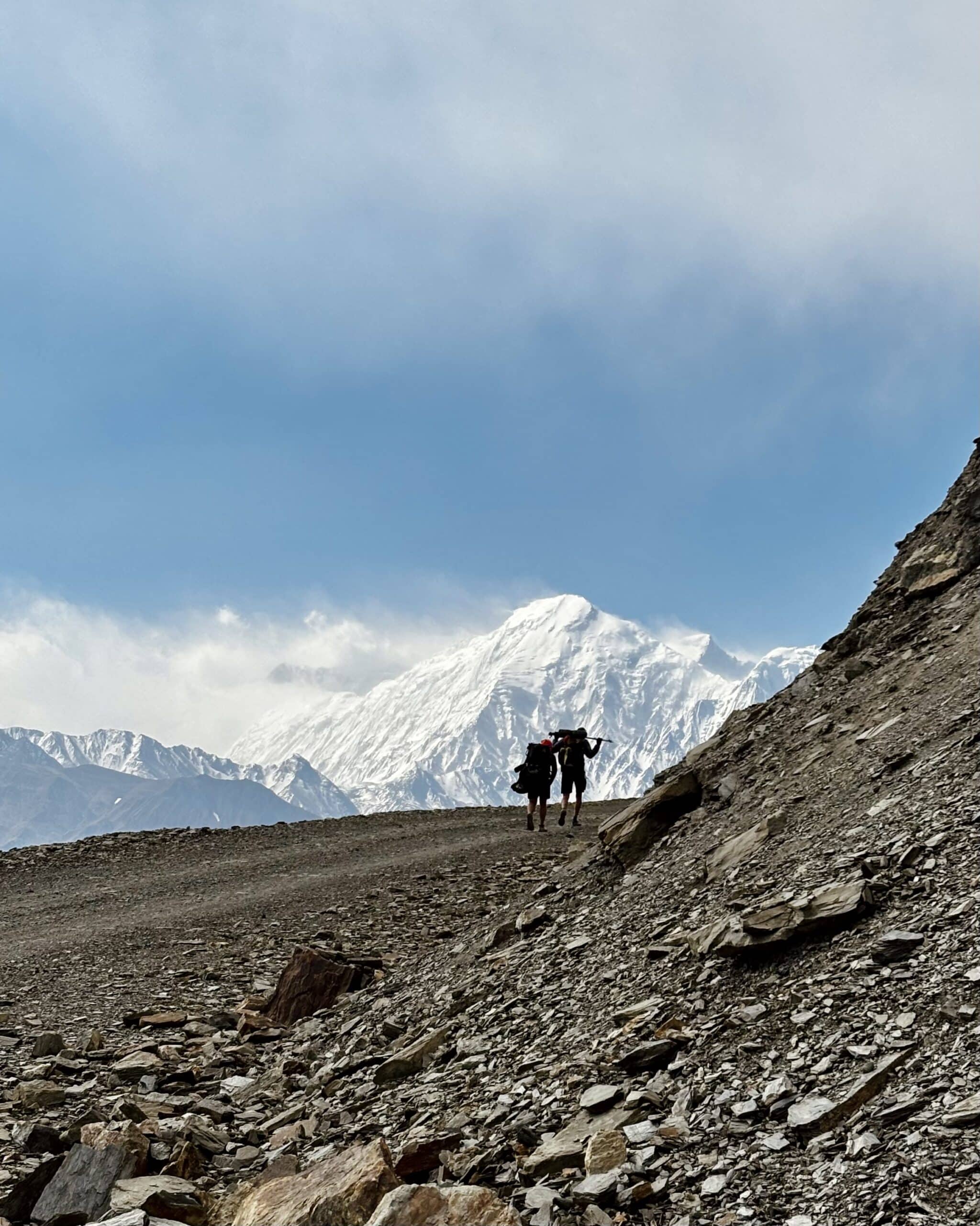
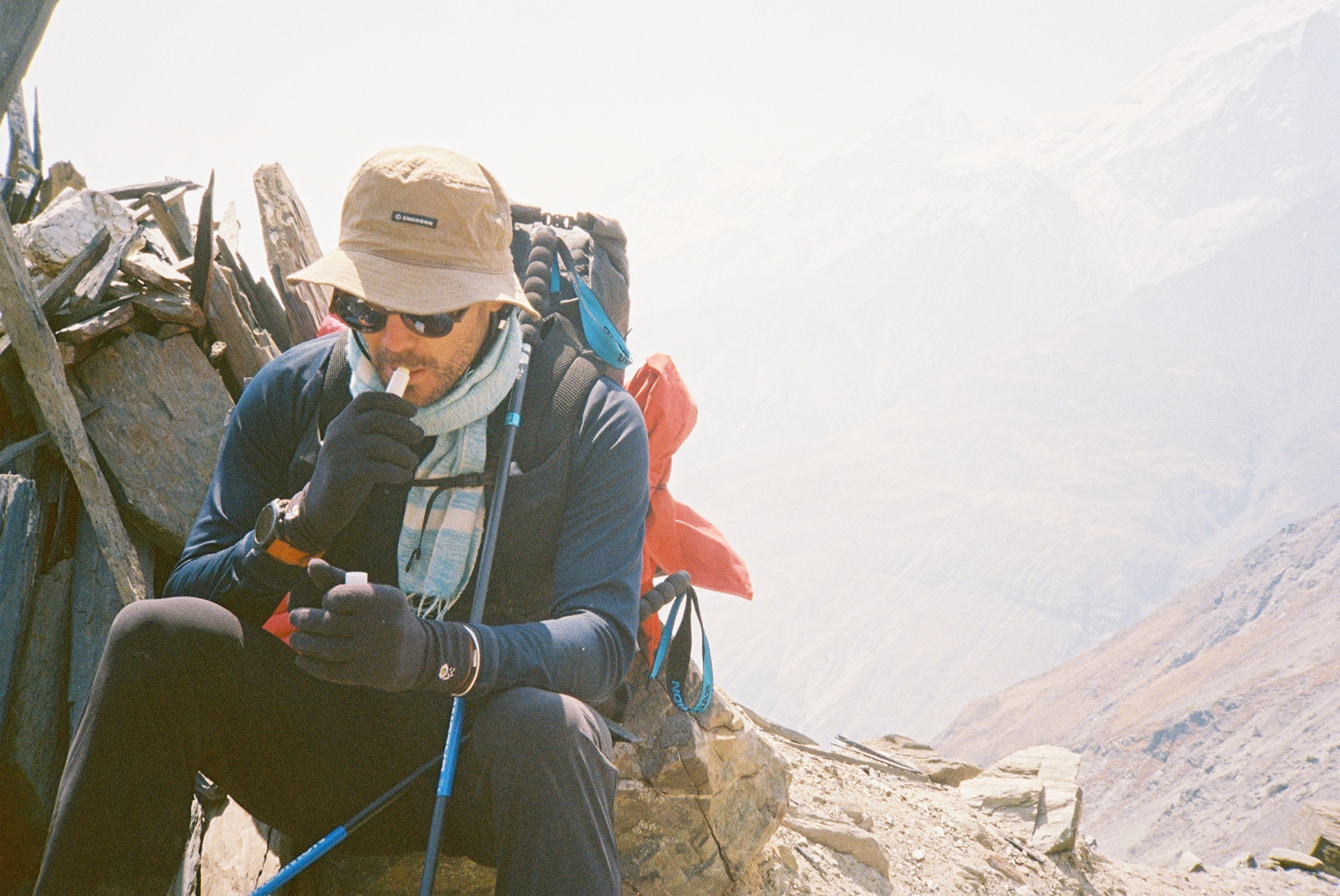
Mountaineering and trekking have become big business in Nepal, and they are highly regulated. Every trip must be organized through a travel agency that issues entry permits for various regions and requires a mandatory guide and porter. However, we wanted to travel independently, carrying everything we needed to make quick progress and complete this Himalayan crossing in just one month.
We opted for a minimalist “fast packing, fast hiking” approach, without tents—just an emergency tarp shelter. Our packs would weigh a maximum of 8–9kg, including food and water. So, we were essentially traveling “off the grid,” bypassing permits, guides, and porters, but with a deep understanding of the maps, topography, and geography of the region. Our plan was straightforward: to depart from the Annapurna range, head west, cross the Mustang District, the Dolpo Region, and Karnali Province, and reach the Indian border while staying as far north as possible, near the base of the Tibetan high plateaus.
It’s important to note that only well-trodden trails appear on regional maps. However, we were planning to primarily follow mule tracks, which are inaccessible for ten months of the year due to snow and monsoons.
Our first few days were filled by a long bus journey from Kathmandu to the Mustang Valley. Upon reaching Jomson, we began our trek towards the sacred village of Muktinath. We chose to acclimatize at an altitude of around 4,500m. This was our only eastward route. Each day, we would climb to 5,000m to prepare our bodies for the altitude, as our first days were going to be intense: we needed to make our way through three passes at over 5,000m to reach Upper Dolpo.
Muktinath, a village at the edge of the Annapurna range, is a popular stop for trekkers, creating a festive atmosphere. The first rapid ascent to 5,000m quickly reminded us of the challenges of altitude sickness; and the hours that followed were far from pleasant. After a few days, once our bodies have adapted to the strenuous climbs, we strapped on our packs—each allowing us to be self-sufficient for three to four days. Our grand departure for Dolpo had been slated for the early afternoon, and we anticipated entering the region by nightfall.
And so we descended from the Annapurnas, crossed the Mustang Valley amid gusty winds, and entered the remote Mustang region bordering Dolpo. We were relieved to find shelter in a goat shed and meet a kind shepherd. Verbal communication tended to be limited, as our basic knowledge of Nepalese was of little use: most people we encountered spoke either Tibetan or one of the 120 local languages.
The next day brought a challenging mountain crossing under winter conditions, with strong winds and snow. We set out at dawn, planning to end the day, as usual, at sunset in a muleteer’s shelter at 4,500 meters altitude.
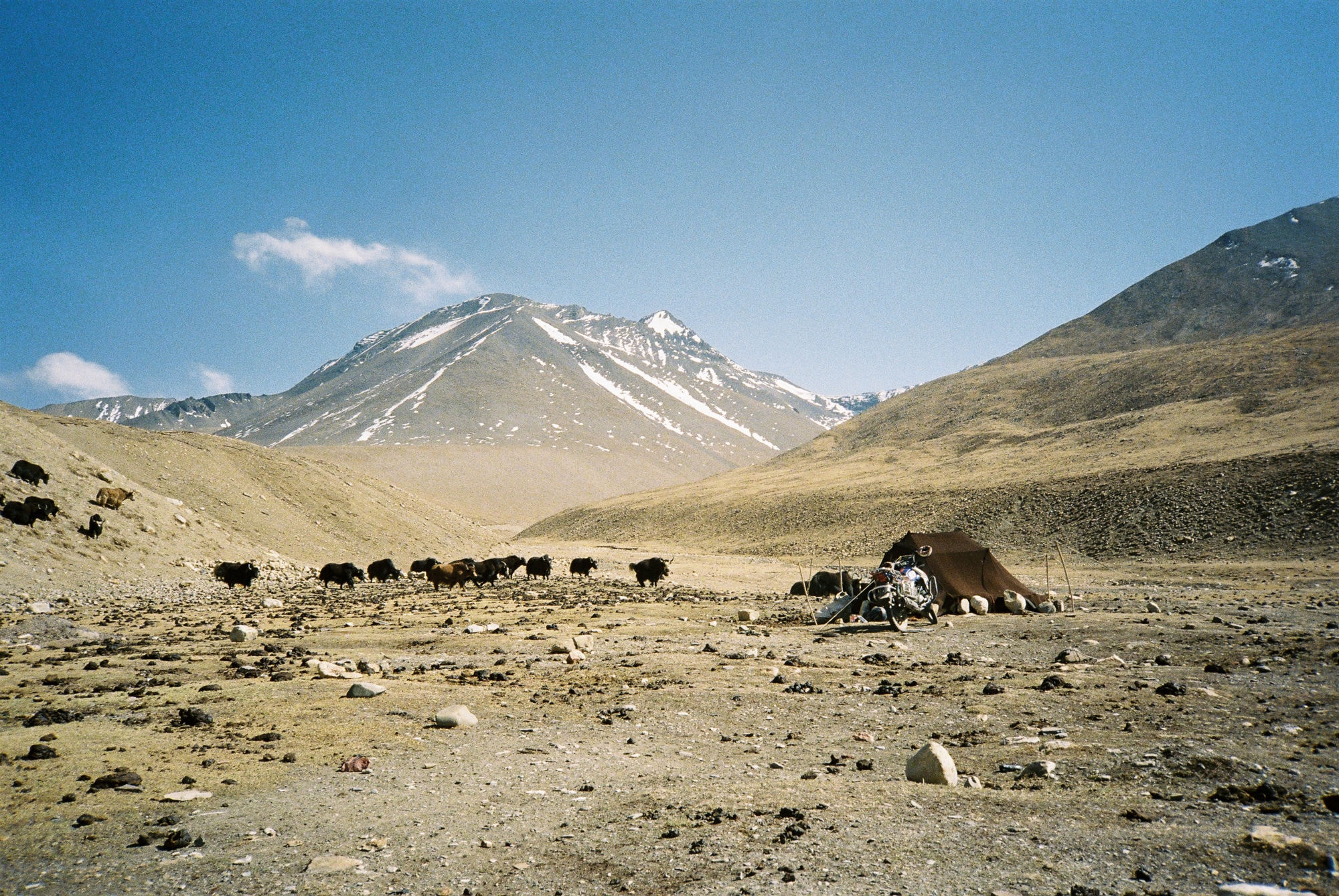
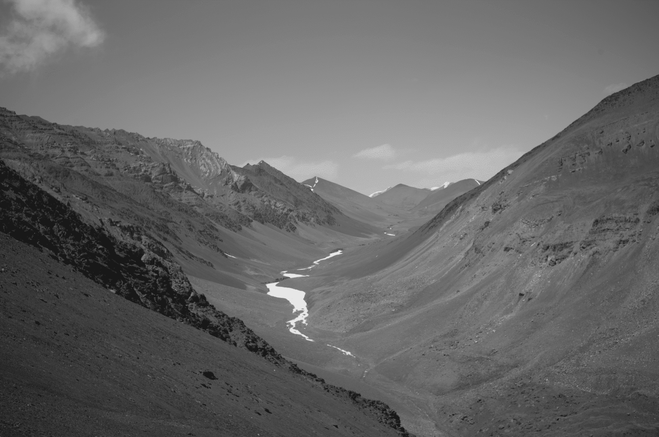
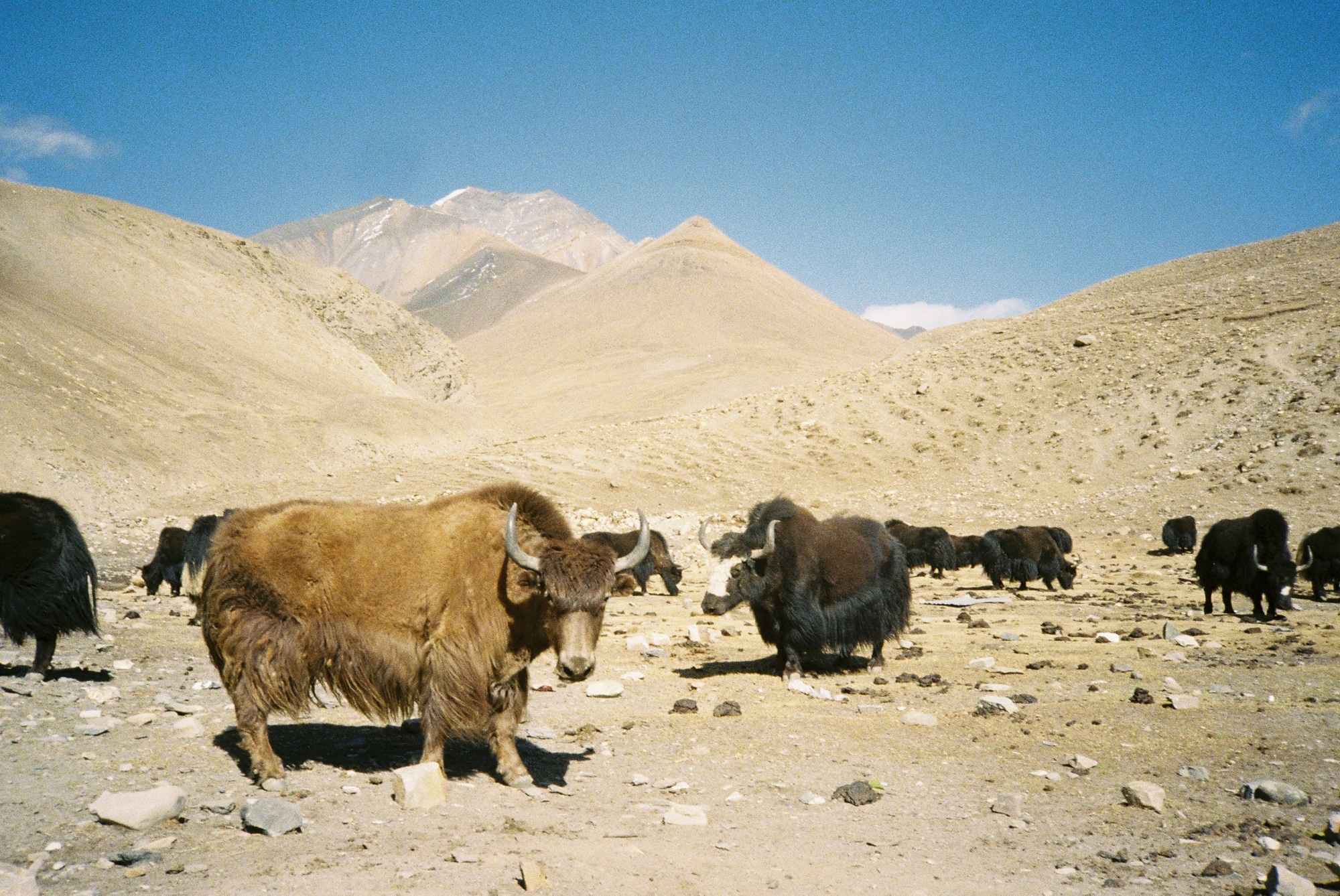
The following day was the most demanding in terms of altitude: we were to cross two passes, each over 5,000 meters, with few tracks to follow due to the recently melted snow. We finished by scrambling—a mix of walking and climbing—without safety ropes, at 5,500 meters. This was the only possible route into Upper Dolpo. The descent into the Hidden Valley seemed endless as we passed wild yaks, some in herds, and finally arrived, breathless, in Charka Bott, the highest village in the world at 4,400 meters, nearly at the altitude of Mont Blanc’s peak. The village’s lama offered us lodging, where we stayed for 24 hours.
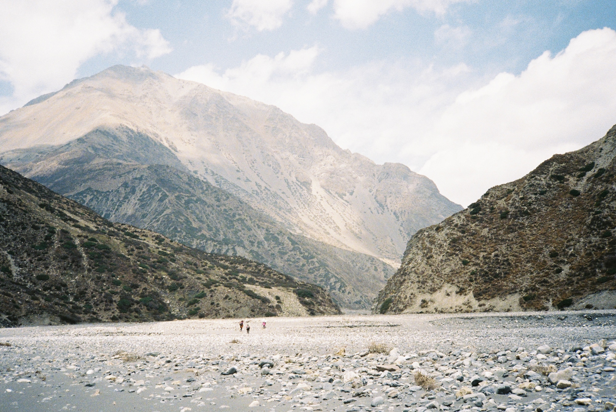
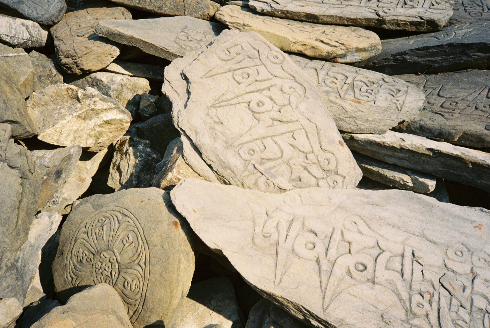
This introduction to Dolpo set the tone for the days ahead: mule tracks, not a soul in sight, the Tibetan border close at hand, and Buddhism omnipresent. Our days blurred together as we covered 40 to 50 km on foot, moving from Upper to Lower Dolpo. With our food supplies dwindling, we decided to exit Dolpo by night, carefully studying maps to avoid all the checkpoints.
The day we got to the town at the edge of the vast valley we’d spent several days crossing was exceptionally long: over 50 km with nothing left to eat. We arrived in Dunai and its military base by evening, scattered and exhausted. The night was short, and the following day was spent finding a way out while avoiding checkpoints (a reminder that our self-guided journey was somewhat illegal).
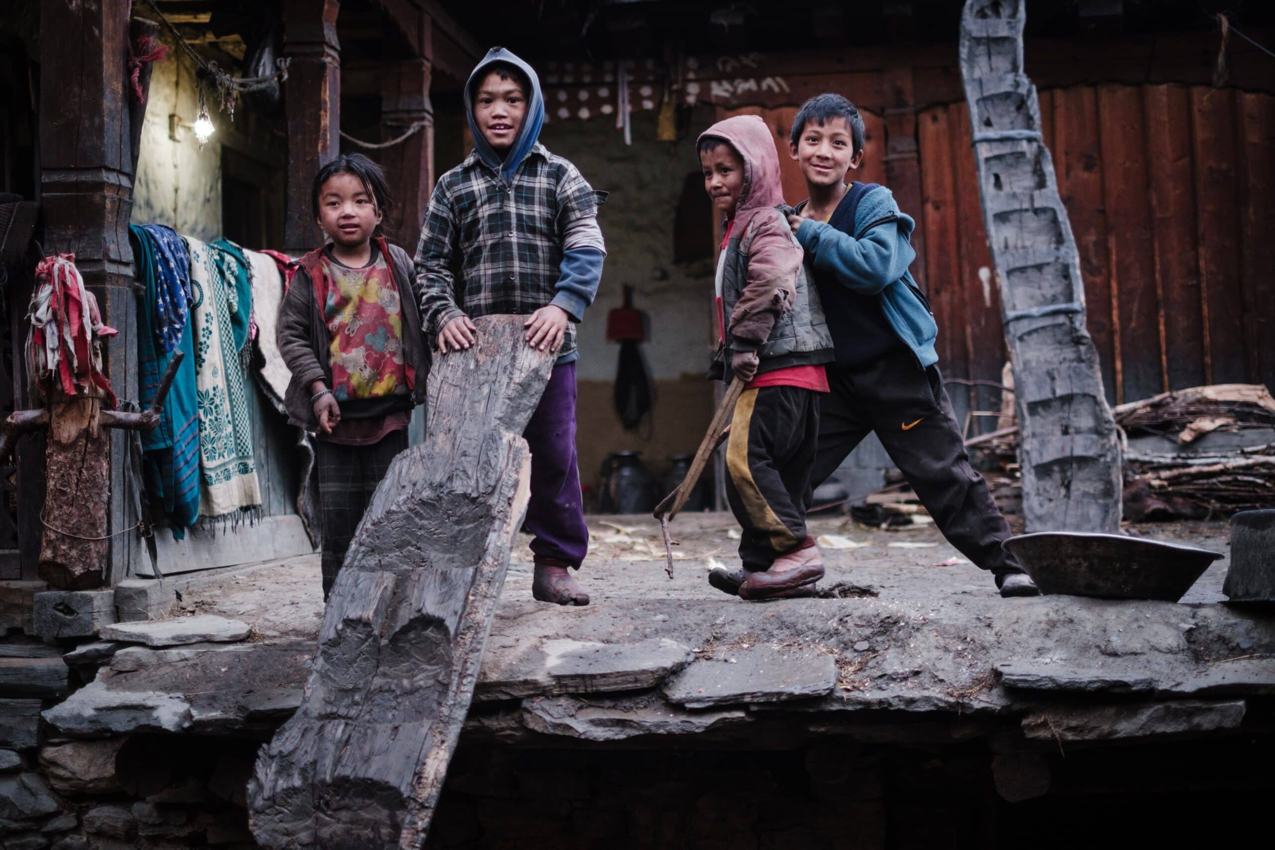
At dawn, we made our way across the big river into the mountains to leave the forbidden zone behind. After a brief scare when we encountered some soldiers (the risk being expulsion from the country), we finally emerged, relieved of this mental burden, and continued on our way, as joyful as children. We passed through small villages, each with its own unique atmosphere. Music could be heard before the children left for school. We sparked curiosity wherever we went.
“Walking through the small villages of western Nepal is like moving through a living painting. Every house tells a story, every encounter is a unique exchange. The laughter of children, the song of birds, and the gentle murmur of rivers create a symphony that makes every step an unforgettable experience.” – Samuel Urtado
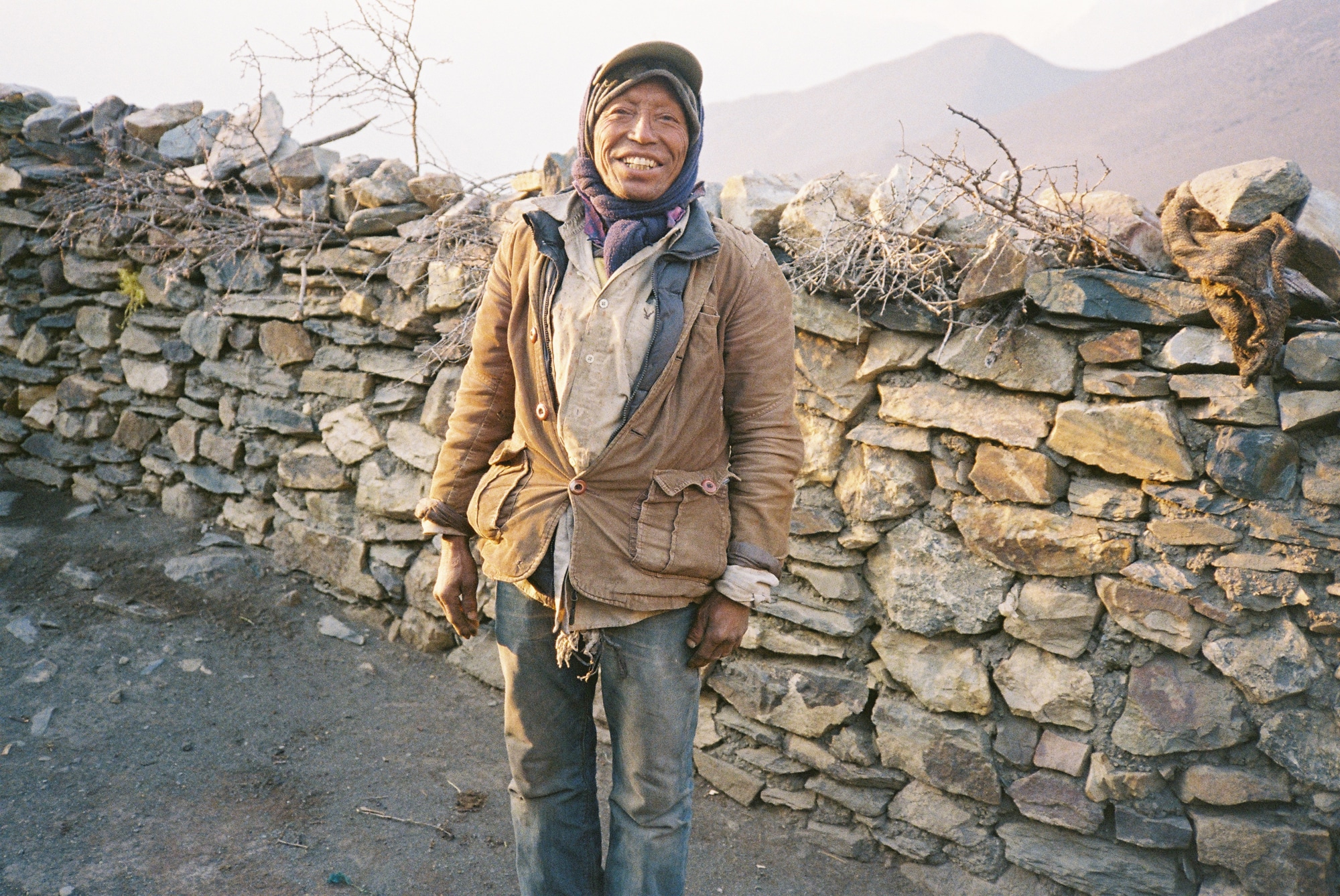
We passed many heavily laden hikers heading in the opposite direction, towards Upper Dolpo on the border with Tibet, in search of yarsagumba (also known as cordyceps or caterpillar fungus), a mushroom prized for its health benefits by both Chinese and Westerners. Northern Nepal has become heavily economically dependent on the trade of this mushroom, which fetches a high price and is found mainly in the Nepalese highlands.
The fascinating story of how these mushrooms are harvested is detailed in the documentary Searching for Yarsagumba in Nepal, available for free on YouTube on the Himalayan Archives channel. A Nepalese picker we met along the way shared his daily routine: “Loaded up like yaks, we climb the steep slopes, our eyes fixed on the ground, searching for the precious cordyceps. Every step is a struggle, but the promise of this rare find drives us forward. It’s a difficult quest, but here in these mountains, cordyceps is more precious than gold.”
The next few days were dedicated to reaching the capital of western Nepal, Jumla, and were filled with many wonderful encounters, rich in humanity. As we descended in altitude, crops became abundant—mainly potatoes, rice, and lentils, which form the foundation of the staple Nepalese dish: dal bhat, literally “lentils with rice.” We observed the different preparations as we traveled through various regions and discovered the diverse cooking methods—it was truly fascinating. Typically, in the evenings, when we arrived at a local’s home, we watched as the women spent an hour and a half preparing dal bhat to feed the entire family.
We stayed in Jumla for 48 hours, initially to recover our strength. We were halfway through our journey and battling food poisoning that left us feverish and weak. This kind of nomadic journey drains the body with its constant unpredictability and intensity. There is no comfort. The nights are short, spent on uneven slopes, and the days are long and grueling, with a daily shortage of calories. But this is what we came for: a return to the essentials.


From Jumla, we headed north once again, searching for a route that would take us directly westward. This route had either never been used before or was last traveled a long time ago, as it winds through dense mountain ranges.
We passed Lake Rara, the highest lake in the country, located in the national park of the same name. For several days, we followed endless waterways. Sometimes we had to cross from one bank to the other, with paths rendered impassable by massive landslides or washed out by the annual monsoon. Occasionally, there were bridges; other times, they were destroyed or nonexistent, forcing us to find fords.
Finally, we reached a point of no return: after several days of pushing through the foothills of the Tibetan plateau, we realized that it would be impossible to take our last shortcut to the west. The mountains were too rugged, the paths nonexistent, and, above all, we were running out of food. We made the difficult decision to retrace a two days’ journey, taking a lower-lying route that would allow us to complete our journey westward.
On the way back down, we were reminded of the intense heat baking India and southern Nepal. Our spirits were low, but there was no time to rest: we had to keep moving, day after day, until we reached the border.
The last few days were particularly tough on our bodies. We arrived at the border separately. Bertrand continued on to India, as he had planned a full trans-Himalayan tour. Clément and I returned to Kathmandu. This marked the end of a journey of rare intensity and challenge. We were exhausted but happy. We looked at each other and all agreed, “This was clearly the most intense trip we’ve ever been on.”
“We’ve been home for two and a half months now, and the recovery process has been long and gradual. I finally feel ready to lace up my trail shoes again for the Ultra-Trail du Mont Blanc this week” – Samuel Urtado
A life lesson
For travelers seeking authenticity and deep human connections, western Nepal offers an experience like no other. The rugged beauty of the landscape, the warmth of the local people, and the rich cultural heritage of the region are treasures waiting to be discovered. Venturing into this remote part of Nepal is to immerse oneself in a world where tradition and nature harmoniously coexist, far from the hustle and bustle of modern life.
Western Nepal remains a stronghold of living traditions and unspoiled natural beauty. Its isolation, while sometimes a challenge for its inhabitants, has preserved a way of life that is vanishing elsewhere. The challenges are numerous, but with targeted initiatives that respect the environment and local cultures, the region has the potential to foster a future where development and tradition coexist harmoniously.
Our journey was a step back in time, an immersion in preserved cultures, and an exploration of breathtaking landscapes. Western Nepal is truly a hidden gem in the heart of the Himalayas.
More information:
Bertrand Courtot is currently completing his trans-Himalayan journey, arriving at the foot of Nanga Parbat in Pakistan, the westernmost of the Himalayan peaks over 8,000 meters.
Clément Cangiano et Samuel Urtado have returned home and are now preparing an exhibition and editing a documentary about their journey.
In the meantime, you can purchase Clément Cangiano here.
Stephen Rater, who illustrated this article and is passionate about Nepal, is organizing an astronomy trek in the Solu region, Sherpa territory, from November 10 to 25. For more information and reservations, contact him on Instagram. contactez le sur instagram. For detailed information about the trek, visit: Panorama Trekking.
Samuel Urtado offers regular micro-adventure trips. You can follow his adventures on instagram.
#ultracitadins is a project of 3 documentaries. The first tells the story of Team Trail Paris, which ran the 750km from Paris to Annecy (the northern entrance to the Alps) in less than 75 hours. The second was their Nepalese adventure. And the third, the descent of the wild Rhône from the glacier to the sea, by 2 Parisian friends, Samuel Urtado and Thibaut Lamy. The 3 documentaries are directed by Clément Cangiano and produced by GORIS film.